Geoscience Reference
In-Depth Information
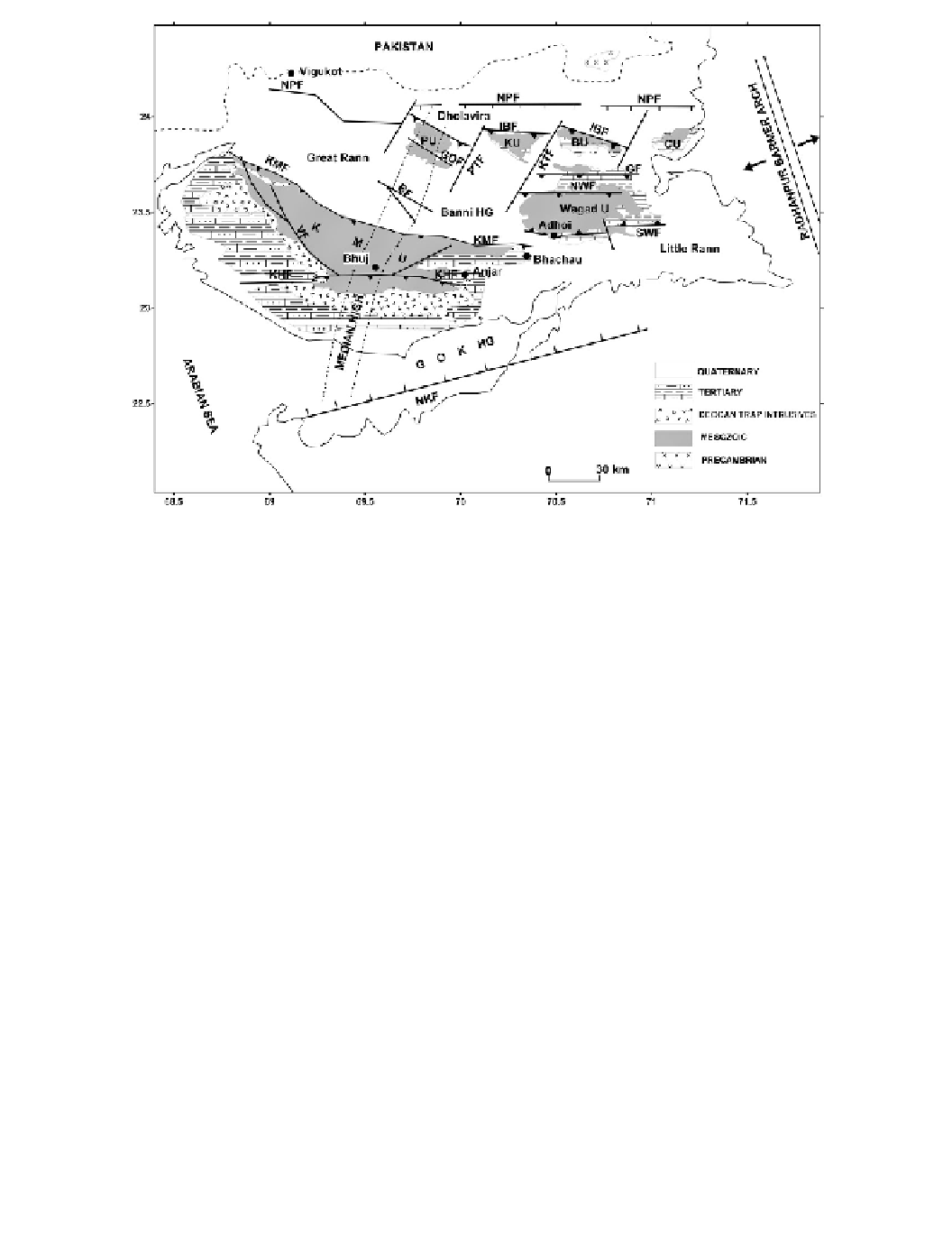
IBF, Island Belt; KMF, Kachchh Mainland; KHF, Katrol Hill; NPF, Nagar Parkar; NKF, North
Kathiawar; VF, Vigodi; GDF, Gora Dungar; BF, Banni; GF: Gedi. Uplifts: PU, Pachham Is.; KU,
Khadir Is.; BU, Bela Is.; CU, Chorar Is.; Wagad U, Wagad Uplift; KMU, Kachchh Mainland Uplift.
HG, Half-Graben. GOKHG, Gulf of Kutch Half-Graben.
that crosses the basin at right angles to its axis in the middle. Acting as a hinge it divides
the basin into a deeper western part and a shallower and more tectonic eastern part. We also
notice that the KR is terminated in the east against a transverse subsurface basement ridge,
the Radhanpur Arch, which is the western shoulder of the adjacent N-S oriented Cambay
rift, and, to the west the KR merges with the offshore shelf.
A south to north depth section (
Figure 6.3b
)
depicts possible dip directions of faults
seismological and geophysical data is shown in
Figure 6.3c
.
The dip directions of the KMF
and SWF inferred by Biswas are towards the south and north, respectively, and opposite
to the dip directions inferred by Biswas. Biswas assumes that the dip directions of the
two faults are towards each other, so that the low-lying Samkhiali and Banni grabens may
be formed. However, Rastogi opines that the Kachchh Mainland can uplift only along a
south-dipping fault while the Wagad can uplift only along a north-dipping fault. Once the
uplifts are formed, the area between the two uplifts will be low-lying. The Bouguer anomaly
indicates that the basement has not gone down in the Samkhiali and Banni with respect to
that at the Wagad and Kachchh Mainland. From trenching, Morino
et al
. (2008a, b) inferred