Geoscience Reference
In-Depth Information
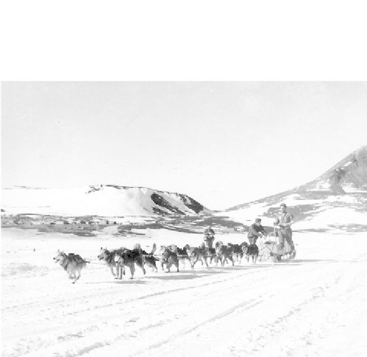
Figure 2.3
In the early days of geological exploration of Antarctica geologists used dog teams
to travel from one location to another collecting rock samples. This photo shows Lieutenant
Jack Tuck (US Navy) on the annual sea ice near what is today known as McMurdo Station.
(Credit: US Navy, NSF)
airborne magnetic and gravity surveys that detect the different physical properties
of the rocks below, and oversnow seismic techniques that image re
ective horizons
within geological strata. In recent years, major international consortia have been
able to drill down through the ice into the Earth
s outer crustal layer to sample rocks
up to 1170m below the ground surface. A recent international ANDRILL (Antarctic
Geological Drilling) project has brought together scientists from the United States,
New Zealand, Germany and Italy to develop modern drilling technology. Their
rock cores have provided a unique record of how Antarctic climate has changed over
the last 30 to 40million years, from close to the time when Antarctica, although still
at the South Pole, was part of a greenhouse world devoid of ice. This information
is critical for measuring global climate change, now seemingly accelerating.
There are many isolated rocky mountain peaks, known as nunataks, that protrude
through the icy carapace, particularly near the periphery of the Antarctic continent.
But it is three spectacular mountain ranges that provide the most amazing insights
into the geology of the frozen continent: the Transantarctic Mountains, a high
'


Search WWH ::

Custom Search