Geoscience Reference
In-Depth Information
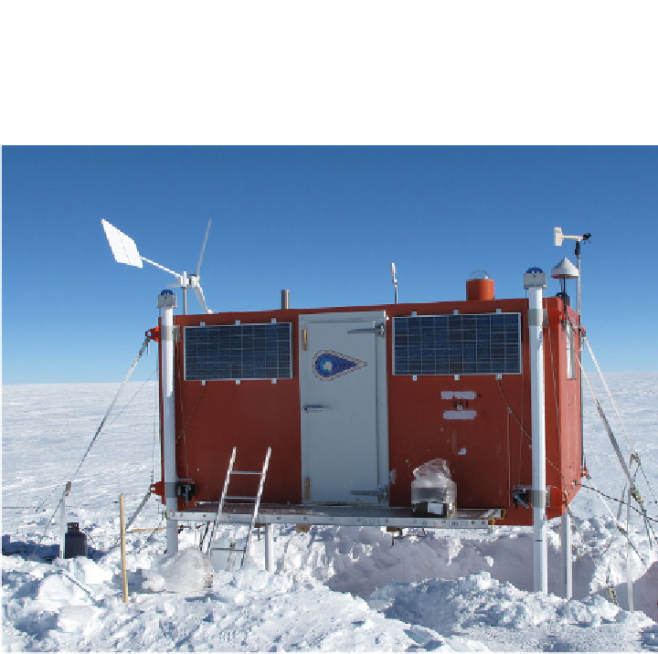
Figure 7.7
The wind and solar powered US Automatic Geophysical Observatory (AGO).
These remote platforms on the Antarctic plateau consist of a suite of instruments used to
monitor the space environment of Earth over a range of radio and optical wavelengths.
Real-time data acquisition via satellites enables forecasting and now-casting capabilities for
space weather applications. Although the AGOs were originally intended as space physics
platforms (optical and radio wave auroral imagers, magnetometers and narrow- and
wide-band radio receivers), the reliability and
flexibility of the design has enabled other
disciplines to leverage the location and infrastructure for new scienti
c instruments including
seismometers, comprehensive weather stations and astrophysical sensors.
station) means that during every day a given location on the Antarctic continent will
rotate through a range of geomagnetic latitudes. For example, South Pole station,
at 90 degrees south geographic, has a geomagnetic latitude of about 74
S. Near
local midnight, the South Pole will often be located on magnetic
field lines that
correspond to the auroral zone. Some 12 hours later, the South Pole will have rotated
to be at local noon, and the magnetic
field lines will now map to near the front
boundary of the magnetosphere (where the
field lines separate between those
mapping to the front side and those mapping to the magnetotail). Other locations in
Antarctica will similarly map out a range of geomagnetic latitudes during a local day.
Thus, the rotation of Earth combined with the distribution of stations across


Search WWH ::

Custom Search