Geoscience Reference
In-Depth Information
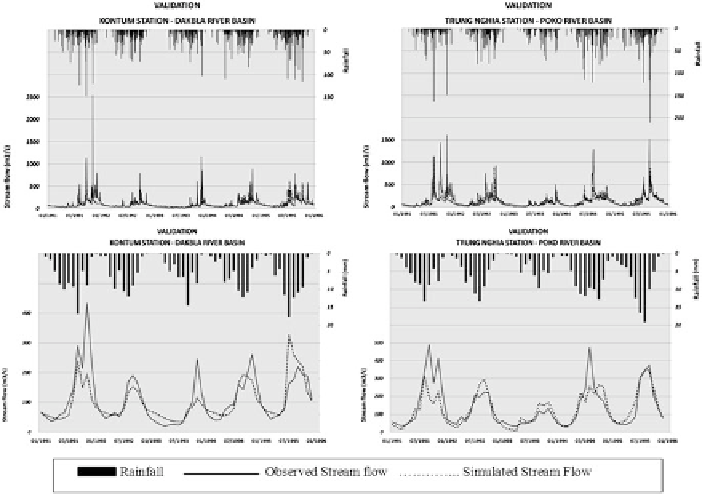
Fig. 17.7
Validation of the model: Dakbla (
left
)andPoko(
right
) river basins on the daily (
top
)
and monthly (
bottom
) scales
applications. The calibration and validation results for Dakbla and Poko rivers are
shown in Figs.
17.6
and
17.7
, respectively.
17.3
RCM Output for Climate Applications
In this study, a regional climate model, Weather Research and Forecasting (WRF),
was used to simulate climate over a part of the Lower Mekong Region at a horizontal
resolution of 30 km centered over the Sesan catchment area. The RCM WRF model
was run for the period 1991-2000 using the National Centers for Environmental
Prediction/National Center for Atmospheric Research (NCEP/NCAR) reanalysis to
assess its performance of the present-day climate. Later, the WRF model was also
run driven by the global climate model ECHAM5 T63 over the same period to assess
the model's performance on the 10 year climatology of the present-day climate.
The rainfall output from the WRF model obtained from the two above mentioned
simulations were then used as input to the calibrated SWAT model to simulate the
stream flow. The simulated stream flow is shown in Fig.
17.8
. Results also indicate
the precipitation output derived from the WRF model driven by the GCM ECHAM5
were better than the NCEP/NCAR reanalysis as the stream flow simulated using
WRF ECHAM5 output agreed better against the station data than the stream flow
Search WWH ::

Custom Search