Geoscience Reference
In-Depth Information
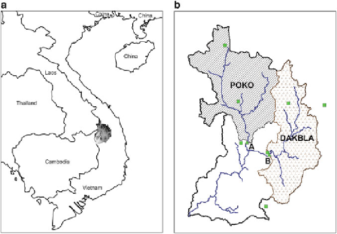
Fig. 17.4
Sesan catchment in Vietnam
The Sesan river basin has a catchment area of 9,030 km
2
which consists of
two sub-catchments, called Poko and Dakbla. Each of these sub-catchments has
a discharge station located closed to the catchment outlet (Fig.
17.4
). There are six
rainfall stations inside and outside the study catchment with three stations for each
sub-basin. The stations marked 'A' and 'B' as small triangles indicate the discharge
stations and the rest of the six square markers indicate the six rainfall stations.
The shaded region in the diagram in the left is magnified for clarity in the right
which shows the two sub-basins considered in this study.
17.2.2
SWAT Model
The SWAT model is a river basin scale model, developed at the United States
Department of Agriculture (USDA)—Agriculture Research Service (ARS) in the
early 1990s (
Arnold et al. 1998
). SWAT is a physically based model which is
designated to work for large river basins and catchments and uses readily available
inputs. It is widely used to study the impacts of land management practices on
water, sediment and agriculture chemical yields with varying soil, land use and
water management conditions. A suite of information about the model and its varied
applications are available at the SWAT website:
http://swatmodel.tamu.edu/.
Search WWH ::

Custom Search