Geoscience Reference
In-Depth Information
150°W
120°W
90°W
60°W
30°W
0°
30°E
60°E
90°E
120°E
150°E
180°
60° N
60°N
30° N 30°N
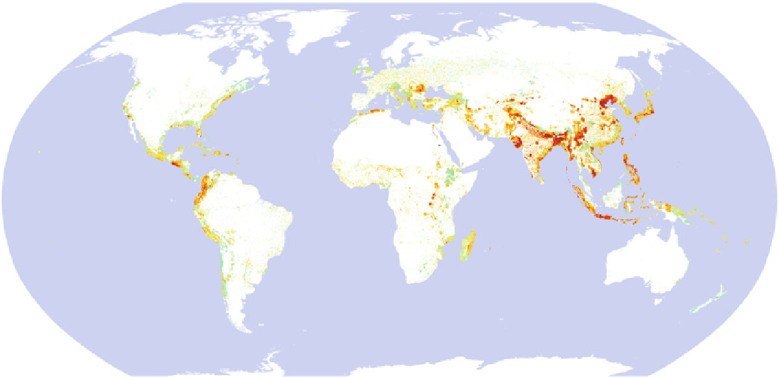
Multi-risk
tropical cyclones, floods
earthquakes, landslides
0°
0°
10 High
9
8
7
30°S
30° S
6
5
4
3
2
1 Low
0 Unknown exposure
60°S
60°S
GIS analysis and cartography
P. Peduzzi, ISDR, UNEP/GRID-Europe, 2009
150° W
120°W
90°W
60°W
30°W
0°
30°E
60°E
90°E
120°E
150°E
180°
Fig. 2.9
Global distribution of multiple hazards mortality risk from tropical cyclones, fl oods, earthquakes, and landslides in 2009 (Image provided by P. Peduzzi,
ISDR, UNEP/GRID-Europe, reproduced from 2009 Global Assessment Report on Disaster Risk Reduction (UNISDR
2009b
) )


Search WWH ::

Custom Search