Geoscience Reference
In-Depth Information
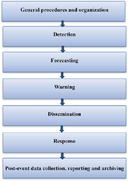
Fig. 10.2
Conceptual model
of fl ood forecasting, warning
and response processes
(Environment Agency
2002
)
(Contains Environment
Agency information ©
Environment Agency and
database right)
10.4.3
Detection
The Environment Agency is an evidenced-based organisation. Data collected in
many parameters is cross-referenced against records of fl ooding. This information
allows staff an understanding of when fl ooding may be possible. To deliver its fl ood
warning service, the Environment Agency has an extensive network of monitoring
stations, measuring many hydrological and meteorological variables including river
level and fl ow, rainfall and tide (Figs.
10.3
,
10.4
, and
10.5
). As many of these sites
are connected via telephone line to the telemetry network, measurements are able to
be viewed remotely in 'real time'. Since 2010, the Environment Agency provides
this data from 2,000 of its sites, for free, in near real time, for example river levels
for Arun and Western Streams
3
(EA
2013i
). Monitoring stations are calibrated and
validated to ensure high-quality information is used for all its applications.
Generally, in the Environment Agency, fl ood warnings are still primarily issued on
the detection of rising water levels. Therefore, data quality is highly important.
Search WWH ::

Custom Search