Geoscience Reference
In-Depth Information
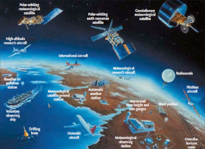
Fig. 6.1
Observing systems in use on the ground, at sea, in the atmosphere, and from space for
monitoring and researching the climate system (WMO
2011
)
assessments and early warning information on the impacts of natural hazards and
human actions on the Earth system. Time-sequenced satellite images help to deter-
mine these impacts and provide scientifi c evidence of substantial changes to the
Earth's environment and natural resource base (i.e., ecosystems changes, urban
growth, trans boundary pollutants, loss of wetlands, etc.).
6.3
Overview of EWS for Rapid/Sudden-Onset Hazards
This section provides an overview of the EWS and monitoring systems that are
known to exist for rapid/sudden-onset hazards. The subsections are organized by
sub hazard type.
6.3.1
Oil Spills
Systems for oil-spill detection currently exist in several parts of the globe. For exam-
ple, in Europe, the use of satellites for oil-spill detection is well established and well
integrated within the national and regional oil pollution surveillance and response
systems. Many countries in Northern Europe currently use the Kongsberg Satellite
Search WWH ::

Custom Search