Geoscience Reference
In-Depth Information
which was also quantified to be 1.2 C (Destouni et al.
2010
). However, in that region, an
additional warming effect of 0.5 C also occurred, because the water withdrawal for
irrigation reduced the river runoff from the drainage basin into the terminal Aral Sea by
80 %. This led to dramatic Aral Sea shrinkage and associated warming due to smaller
E from the smaller Aral Sea surface, which to a large degree counteracted the regional
cooling effect of irrigation (Destouni et al.
2010
). In the following, we will particularly
survey the cross-regional applicability and implications of this relatively simple, yet
potentially widely useful, basin-scale quantification approach to hydro-climatic irrigation
effects, by extending and applying it also to the exorheic and hydro-climatologically
monsoon-driven MRB in India and comparing the results with the previously investigated
endorheic Aral Sea drainage basin and region in Central Asia.
3 Methodology
3.1 Comparative Site Data
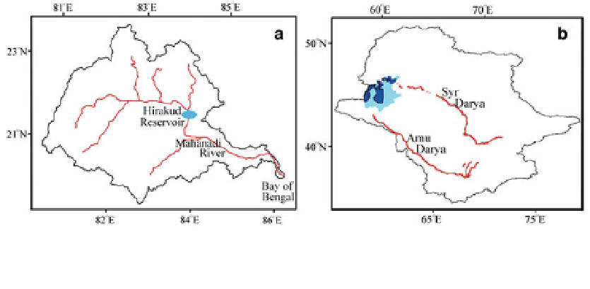
Figure
1
shows location maps, and Table
1
summarizes basin-scale data and water fluxes
for the MRB (with an area of 135,084 km
2
) and the Aral region (with a total area of
1,888,810 km
2
for the Aral Sea and its drainage basin). The analysis focuses on the
twentieth-century historic time span of available hydro-climatic data and compares
changes from the beginning to the end of the century (see specific periods in Table
1
). The
compared time periods are chosen to represent the hydro-climatic situation and associated
major land-use and water-use changes from the time before to the time after the con-
struction of Hirakud dam (shown in Fig.
1
) for the MRB, and before and after the irrigation
development in the Aral Sea region. For the present new application of the approach to the
MRB, we use the same climate database (CRU TS 2.1 by Mitchell and Jones
2005
)asin
the previous hydrological investigation and distributed modeling of this basin by Asokan
et al. (
2010
) and extend here the data analysis to also consider and utilize the seasonality of
surface temperature (T), precipitation (P) and their changes, as previously done and
reported for the Aral Sea region by Destouni et al. (
2010
).
With regard to irrigation, agricultural areas in the MRB are cultivated throughout the
whole year. The cropping seasons are broadly divided into Kharif, the Wet Season, and
Fig. 1 Maps of a Mahanadi River Basin (MRB) in India and b Aral region in Central Asia. The black line
shows the water divides of the basins. The red lines show the major rivers. The light and dark shades of blue
in b illustrate the outline of Aral Sea before and after (in 2005) its major shrinkage