Geoscience Reference
In-Depth Information
180°
120°W
120°E
Ko
Y
u
Le
Ma
In
Ya
Ne
Ol
Ye
Ch
Kh
Ob
Pe
SD
60°W
60°E
0°
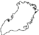
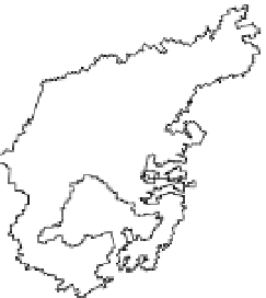
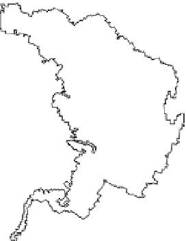
Fig. 1 Map indicating studied areas of the PADB. Bring and Destouni (
2009
) includes all areas within the
PADB, demarcated by the combined area of all colored basins and the dark gray area. MG&IC: Mountain
glaciers and ice caps; GRIS: Greenland ice sheet. Basin names are abbreviated as Ne Nelson, Ch Churchill,
Ma Mackenzie, Ko Kolyma, Kh Khatanga, Ol Olenek, Le Lena, Ya Yana, In Indigirka, Ye Yenisey, SD
Severnaya Dvina, Pe Pechora and Yu Yukon. Lambert azimuthal equal-area projection; approximate scale
1:150,000,000. Spatial resolution of basin outlines is 0.5
14-basin average values of TAR and AR4 temperature and precipitation (downloaded from
http://www.ipcc-data.ch
;
included models summarized in Table
1
) with observations
(CRU TS 2.1, Mitchell and Jones
2005
) for the periods 1961-1990, 1991-2002 (obser-
vations) and projections for 2010-2039 (GCMs).
We then investigate in more detail the AR4 model results for the historical 20C3M
scenario and the period 1961-1990, by calculating three separate measures of model
performance: mean absolute error (MAE), mean bias error (MBE) and an index of model
performance (d
r
). For a given drainage basin, the MAE is defined as