Geoscience Reference
In-Depth Information
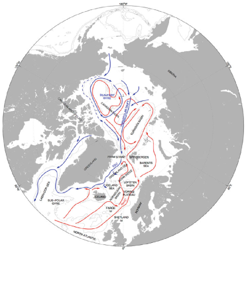
Fig. 1 General circulation of the Arctic Ocean, Nordic Seas, and North Atlantic. Bottom contours are 1000
and 3000 m outlining the shelves and basins. Red arrows represent Atlantic Waters, which reside in the
surface in the Nordic Seas and submerged in the Arctic Ocean. Blue arrows represent Polar Water, residing
in the surface. The Norwegian Sea comprises the Norwegian Basin, while Lofoten Basin, while the Nordic
Seas are the Norwegian, Iceland and Greenland Seas. Circulation patterns based on AMAP (
1998
) and
Furevik and Nilsen (
2005
)
2 Ocean Dynamic Topography
Measurements of the sea surface height have been routinely obtained from satellite
altimeter missions, such as the TOPEX/POSEIDON (Fu et al.
2001
; Shum et al.
2010
), in
the last 20 years. Today, the annual mean sea surface (MSS) height derived from altimetry
is known with millimeter accuracy (e.g., Cazenave et al.
2009
) in the open ocean. In
addition, knowledge of the marine geoid has drastically improved thanks to satellite
gravity measurements from the NASA GRACE (Maximenko et al.
2009
) and ESA GOCE
(Johannessen et al.
2003
; Bingham et al.
2011
; Knudsen et al.
2011
) missions in the last
decade. In turn, the MDT, which is simply the difference between the mean sea surface
height (MSS) and the geoid (G) (both referenced to the same ellipsoid as illustrated in