Geoscience Reference
In-Depth Information
the model background but are snow covered in the satellite-derived product, are updated
with a constant snow depth of 0.1 m of density 100 kg m
−
2
. In the second step, obser-
vations from ground stations reports and snow-free satellite observations (which enter the
analysis with a snow depth equal to 0 m) are assimilated using an OI to produce the
analysed snow field.
As described above for CMC, DWD, ECMWF, NASA/NOAA and NCEP, NWP sys-
tems generally use simple data assimilation approaches to initialise snow depth, ranging
from simple update, Cressman Interpolation and Optimal Interpolation.
2.4 Results
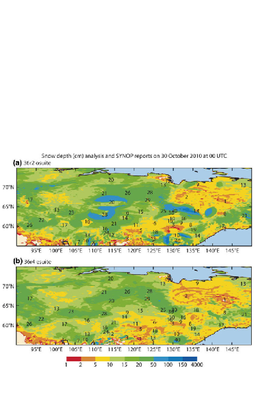
Figure
1
shows snow depth analysis fields in north-east Asia on 30 October 2010, obtained
from the ECMWF Integrated Forecasting System when using a Cressman snow analysis
(top) and an OI snow analysis (bottom). A qualitative comparison shows that the Cressman
analysis produces disc-shaped spurious patterns of snow in northern Asia related to the
Cressman interpolation. The OI presents a smoother and more correct snow analysis
without spurious patterns. The Optimal Interpolation analysis makes a better use of
Fig. 1 Snow depth (cm) fields obtained using (top) a Cressman snow analysis from the operational
ECMWF Integrated Forecasting System and (bottom) an OI snow analysis as tested at ECMWF before
operational implementation, in northern Asia on 30 October 2010. SYNOP snow depth measurements are
reported (cm) in black on the figure