Geoscience Reference
In-Depth Information
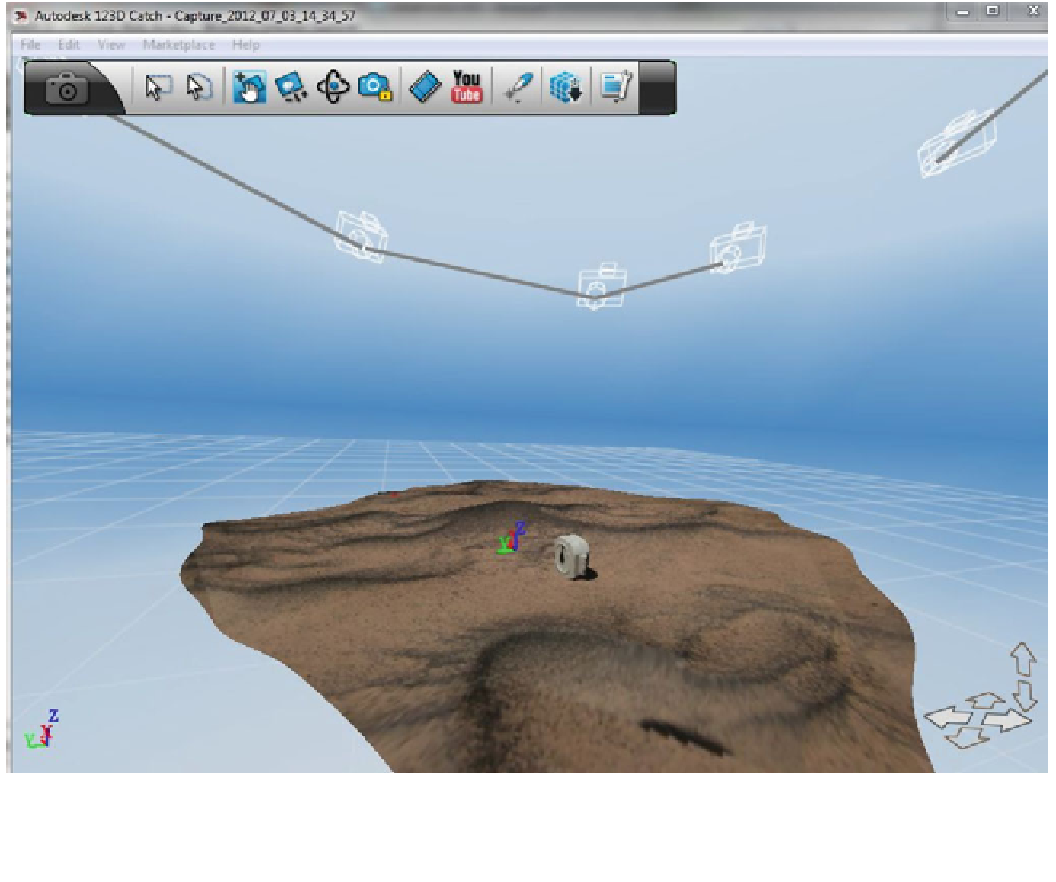
Fig. 16.4
Screenshot of an auto-photogrammetry program (Au-
todesk's 123DCatch) showing the image texture draped over a digital
model of the shape of some ripples; the model can be spun around to
be viewed in different directions, or exported for numerical analysis.
The positions of the camera that have taken the images are
automatically estimated and are shown at the top. A Brunton compass,
in homage to earlier methods, is used to show the scale of the ripple.
Photos J. Zimbelman
used to document changes in dune shape, or in the position
of ripples. So far, no movies of dunes in motion have been
made, but it is likely just a matter of time.
Ripple migration has been observed with timelapse
imaging in Egypt by Lorenz (2011) and at Great Sand Dunes
National Park and Preserve, e.g., Fig.
16.5
, by Lorenz and
Valdez (2011). These papers describe some image process-
ing techniques that can help sift through the prodigious
amount of data that movie sequences can generate. These
observations were used to estimate ripple migration rates
shown in
Chap. 9
from about 1 to 15 mm/min. Sullivan et al.
(2008) report measuring the migration of ripple crests on
Mars by 2 cm towards the Spirit rover at Gusev crater
between sols 1260 and 1265 during a particularly windy
period in 2007 (the first time movement of whole bedforms
was documented by a surface vehicle—see Fig.
16.15
).
Finally, although this verges on aerial photography (see
Chap. 18
), it is possible—indeed, now rather easy, given the
availability of very small digital cameras with timelapse or
video settings— for scientists in the field to obtain images
from a vantage point tens or hundreds of meters up by using
remote-controlled planes or helicopters. These are rather
fun to use, and make a useful bridging scale between the
1-2 m height of field photographs and the distant per-
spective of true aerial or orbital imaging. Aber et al. (2010)
discuss at length the possibilities and techniques of
small-scale aerial photography from kites, drones and bal-
loons. An exciting possibility is the combination of kite
imaging with the new photogrammetry tools mentioned
above to build shape models of dunes quickly in the field.
16.2.3
Thermal Imaging
We discuss thermal imaging in more detail in
Chap. 18
, but
note here an effect seen in field imaging with hand-held
thermal cameras. Avalanching flows can bring sand to the
Search WWH ::

Custom Search