Geoscience Reference
In-Depth Information
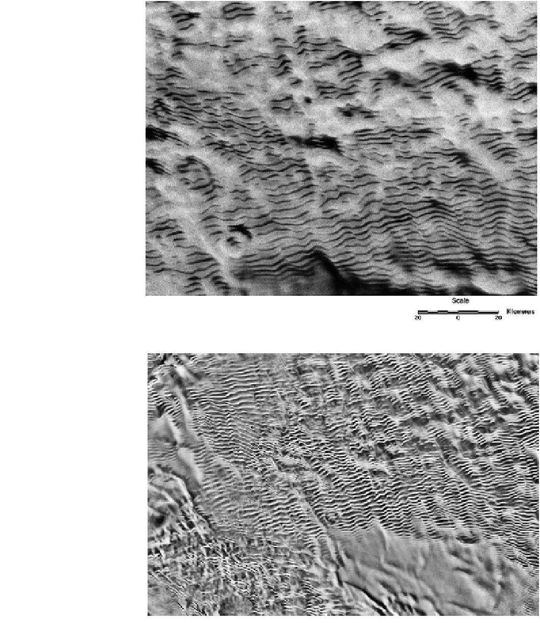
Fig. 11.19
Synthetic Aperture
Radar (RADARSAT) image of
Antarctic megadunes. The
contrast in the image derives
from the different texture of the
dunes and interdunes, not from
topography. These megadunes
were considered as a possible
analog for radar-detected dunes
on Titan, before taller and
straighter examples of
'conventional' linear dunes were
discovered. National Snow and
Ice Data Center/RADARSAT
Canada
Fig. 11.20
An optical image
mosaic generated by stacking six
dithered 250 m-resolution
Moderate Resolution Imaging
Spectroradiometer (MODIS)
images and processing ('super-
resolution') to generate
a *100 m-resolution product.
The formidable extent of the
megadunefield is evident. This
mosaic is part of the National
Snow and Ice Data Center and
the University of New
Hampshire: image made
available by NASA at
earthobservatory.nasa.gov
increasing the roughness height for the surface, to the point
that the height of zero wind velocity exceeds the diameter
of the sand grains. Once this happens, the sand grains no
longer experience the sensible force of the wind. As long as
the plants are present, even after they have died, their
impact on the wind flow can effectively 'stabilize' the sand
to aeolian motion, thus stopping any further migration of
dunes. Even if the plant spatial density is not sufficient to
completely halt the motion of the sand by the wind, the
plants can form local traps for sand on their downwind side,
Search WWH ::

Custom Search