Geoscience Reference
In-Depth Information
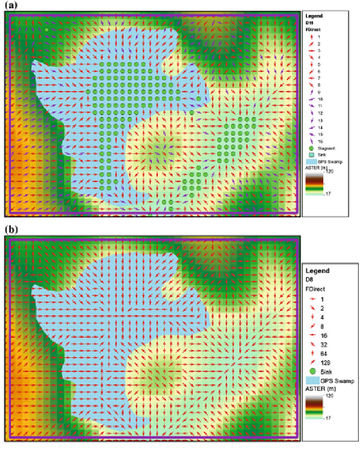
Fig. 18
Comparison of D16 (a) and D8 (b) result on swamp area detection
water supplement management and other application. An automatic detection of
swamp area in the plantation estates can be easily done without embarking on field
collection such as using GPS as presented in blue polygon of Fig.
18
a and b.
Furthermore, D16 is also capable to produce the stream alignment and stream
width using the swamp phase for a larger area. Figures
19
and
20
illustrate the
overall shape of stream network that both algorithms produced in a small-scale
map. The yellow polygon layer is the GPS data on field collection.