Geoscience Reference
In-Depth Information
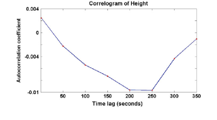
Fig. 14
Correlogram of Height components for time lag 0-350 s
The next phase of the study will involve the implementation of RRTK GPS
technique on real-world landslide sites.
Acknowledgments The authors would like to express their profound appreciation to the
financial support of Flagship UTM Fund (i-Sejahtera—MAWAR), vote number 01G01.
References
Aguado LE, O'Driscoll C, Xia P, Nurutdinov K, Hill C, O'Beirne P (2006) A low-cost, low-
power Galileo/GPS positioning system for monitoring landslides. In: Proceedings of the 2006
Navitec Oct 2006.
http://www.ggphi.eu/monitoring_landslides.pdf
Bertachini E, Capitani A, Capra A, Castagnetti C, Corsini A, Dubbini M, Ronchetti F (2009)
Integrated surveying system for landslide monitoring, Valoria landslide (Appennines of
Modena, Italy). In: FIG working week 2009, Eilat, Israel
Brown N, Troyer L, Zelzer O, van Cranenbroek J (2006) Advances in RTK and post processed
monitoring with single frequency GPS. J Global Position Syst 5(1-2):145-151
Brunner FK, Macheiner K, Woschitz H (2007) Monitoring of deep-seated mass movements. In:
Proceedings of the 3rd international conference on structural health monitoring of intelligent
infrastructure. British Columbia, Canada
Calcaterra S, Cesi C, Di Maio C, Gambino P, Merli K, Vallario M, Vassallo R (2012) Surface
displacements of two landslides evaluated by GPS and inclinometer systems: a case study in
Southern Apennines, Italy. Nat Hazards 61(1):257-266
Chen HY (2001) A study on real-time medium-range carrier phase-based GPS multiple reference
stations. UNISURV S-64, The University of New South Wales, Sydney, Australia, p 182,
ISBN 0 7334 1872 2
Coe JA, Ellis WL, Godt JW, Savage WZ, Savage JE, Michael JA, Kibler JD, Powers PS, Lidke
DJ, Debray S (2003) Seasonal movement of the Slumgullion landslide determined from global
positioning system surveys and field instrumentation, July 1998-March 2002. Eng Geol
68:67-101