Geoscience Reference
In-Depth Information
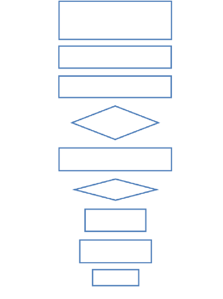
USER INPUT:
Property Type, Price Range
Select Points of Interest (POI)
Distance to POI
Create buffer from user selected POI - temp.
buffer layer
Select Property Polygon layer by temp.
buffer layer
Polygon(s) found
Selection Result
No polygon found
From selected Polygon(s), select where prop-
erty is within price range
No Polygon found
Selection Result
Polygon(s) found
Create Layer from
Selection
Calculate Distance from
Polygon to POI
Display results
Fig. 5
The schematic process of Geo-processing and Geometric network query functions
3.2 Improvising 3D Visualization Functions
The 3D GIS visualization function in the pilot system is switched into the pho-
tographic panoramic display to replace heavy 3D visualization format. Other 3D
visualization techniques will also be tested in the revised system. The proposed