Geoscience Reference
In-Depth Information
Petalin
g Jaya
Na-
tional Bo-
tanic
Garden
Indus-
trial Area
Resi-
dential
Area
District of Selangor
(a)
(c)
(d)
(b)
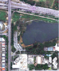
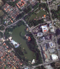
Fig. 1 Location of the study areas a part of Petaling District b Shah Alam Lake Garden,
c Kelana Jaya Recreational Park and d Subang Ria Recreational Park. Source Google Map, 2013
3 Methodology
The methodology adopted for this study is given in the following sub-sections.
3.1 Generation of Land Use/Cover Map
Satellite images are used to generate the land use/land cover maps of two different
dates. The Landsat 5 TM satellite images are acquired from the Malaysian Remote
Sensing Agency (ARSM). The 18 year period is selected to ensure the maturity of
vegetation growth within the study area. The process of generating land use maps
was carried out in the ERDAS Imagine digital image processing software. The
unsupervised classification method is used to generate land use/land cover maps.
The percentages of land use/land cover changes are later calculated.