Geoscience Reference
In-Depth Information
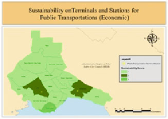
Map 2
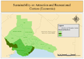
Map 1
Fig. 4 Attraction and recreational centres (Map 1) and Terminals and stations for public
transportations sustainability (Map 2)
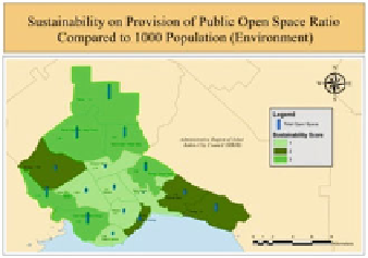
Map 4
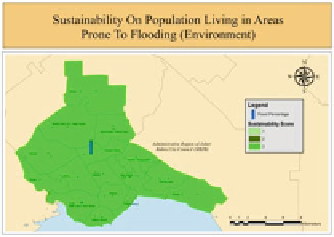
Map 3
Fig. 5 Population living in areas prone to flooding sustainability (Map 3) and Provision of
public open space ratio compared to 1,000 population sustainability (Map 4)
the least populated area with only 7,852 people. The map also shows that Tebrau is
the largest area with a total size 27.24 km
2
.
The accessibility from residential areas to community facilities is determined
by proximity analysis. Map 6 shows that Majidee is the only sustainable planning
block with 81 % accessibility. Kempas, Tampoi, Larkin, Daerah Sentral, Pelangi,
and Mount Austin/Taman Daya are categorized as semi-sustainable planning
blocks with 50-80 % accessibility to community facilities. Other planning blocks
are classified as not sustainable. Map 7 shows that the majority of respondents are
satisfied with their daily life and the surroundings. Respondents in Teluk Tebrau,
Mount Austin/Taman Daya, and Tebrau feel that they are partially satisfied with
the surroundings. Both maps show that the most socially sustainable area is
Majidee which achieves the highest score for both indicators. Kempas, Tampoi,
Larkin, Pelangi, and Daerah Sentral are classified as semi-sustainable with the
highest and second highest scores for both indicators.