Geoscience Reference
In-Depth Information
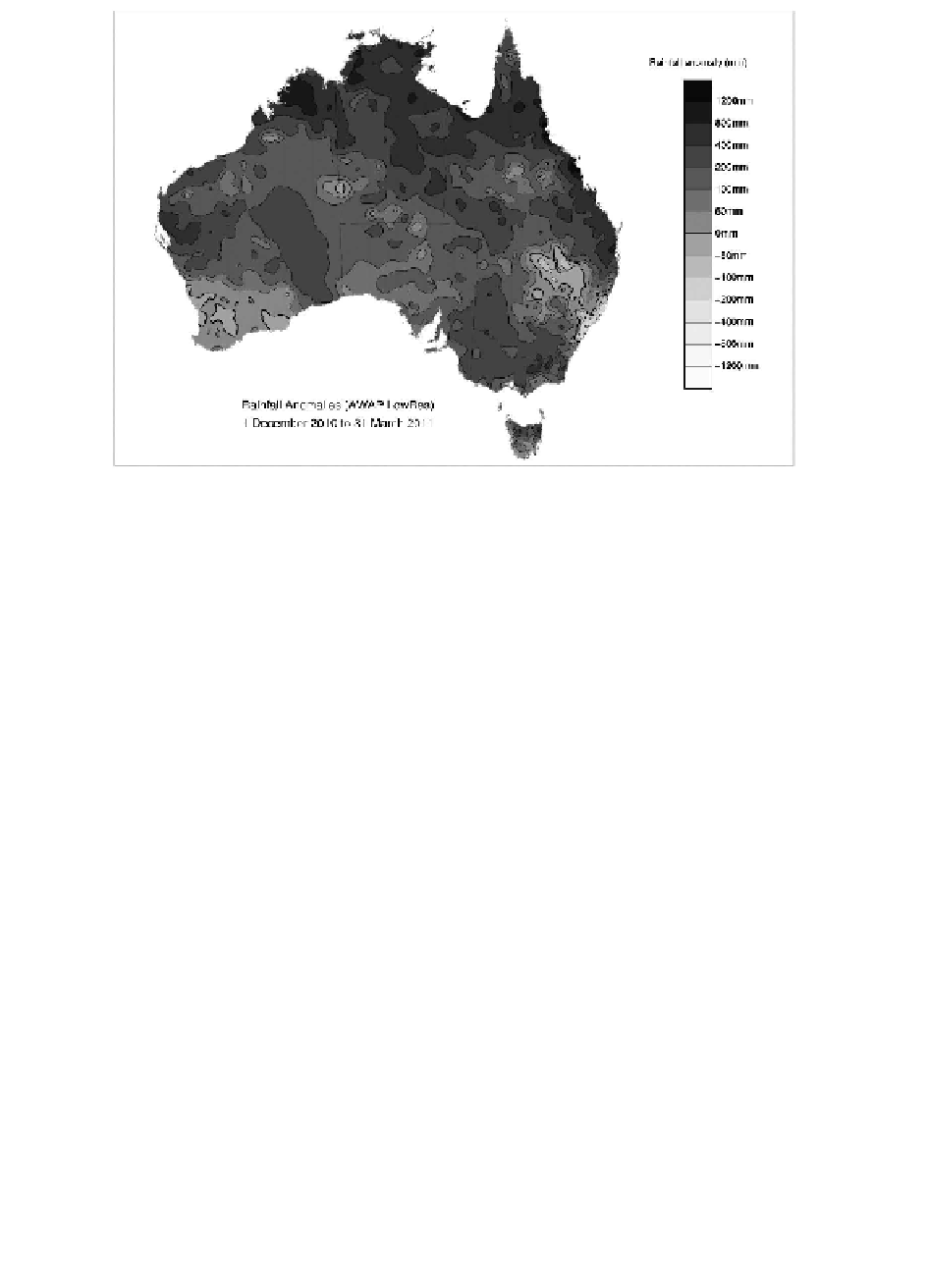
Rainfall anomaly (mm )
1200mm
BOOmm
400mm
200mm
100mm
50mm
Omm
-50mm
-100mm
-200mm
-400mm
-800mm
-1200mm
Rainfall Anomalies (AWAP LowRes)
1 December 201 0 to 31 March 2011
Figure 3.7
Rainfall anomalies (departure from 1961-1990 average rainfall) in mm for
December 2010 to February 2011
Source: Bureau of Meteorology (Australia)
Noteworth extreme rainfall
Extreme rainfall was observed over the Kimberley region of Western Australia
and adjacent parts of the Northern Territory during the first half of March 2011.
Over 300mm of rain fell between 1 and 16 March across central and eastern
regions of the Kimberley with more than 700 mm falling over the Kimberley
Plateau, setting new rainfall records for the region.
In early March 2011 a tropical low pressure system caused falls of over 200mm
in the southern Gulf coast of Queensland on 2 March before moving southward
through the state producing more heavy falls. Notable daily falls from this system
included 477mm at Mornington Island on 1 March and 319mm at Bedourie on
6 March.
Exceptionally heavy rainfall occurred in northeast Tasmania on 23 and 24
March 2011 as a complex area of low pressure moved near the state. Gray
(Dalmayne Road) recorded 327.2mm in 24 hours, making it Tasmania's third-
highest daily rainfall total on record. The two-day totals were also extreme, with
Gray's total of 452.4mm having only been exceeded once before, on 4-5 April
1929.
Heavy rainfall and flash flooding persisted between 9 and 15 January 2011,
resulting in rainfall totals of 100-300mm across two-thirds of the state and conse-
quently major and moderate flooding spanning north, west and central Victoria.