Geoscience Reference
In-Depth Information
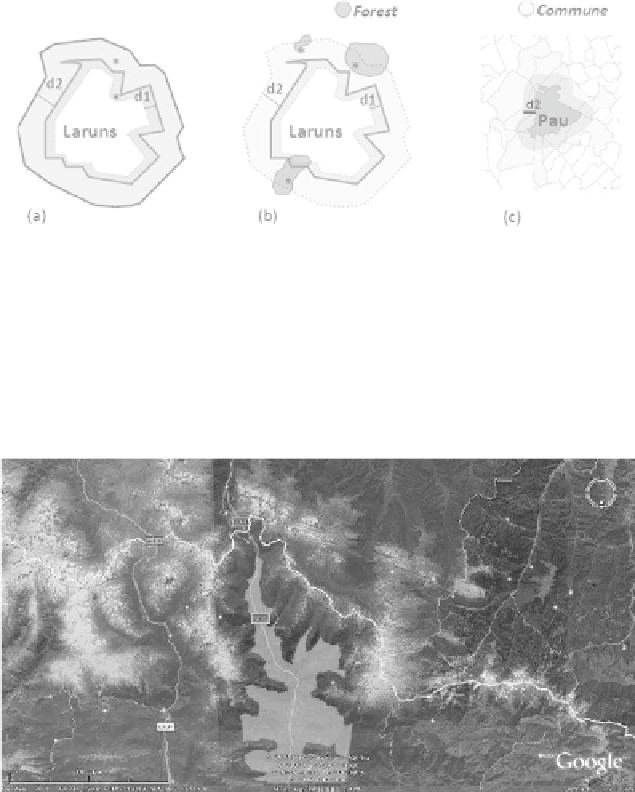
which would allow us to modify its behavior. Figure 4.3 illustrates uses of these four
parameters: the geometry geom of reference SF, the overlap distance with the
reference SF d1, the scope d2 of the relation and the nature of the phenomenon to
observe (“neighborhood”, “pass”, “hut”, “fall”, etc.). Figure 4.3(a) corresponds to the
definition of a geographic zone that, at the same time, covers (over a distance d1) a
part of the reference SF and extends it (over a distance d2). Figures 4.3(b) and (c)
illustrate the restriction of the scope of the zone thus defined to the zones of a given
category (e.g. “forest” and “commune” - (b) and (c), respectively).
Figure 4.3. Interpretation of adjacency: advanced adjacency function
It would be equally interesting to rework the punctual or linear SFs. The
representation of an adjacency relative to a peak or to a thalweg line could therefore
be adjusted as a function of an interval whose bounds correspond to elevation levels.
Figure 4.4 presents the valley of Aspe by visualizing the corresponding thalweg line
combined with an altitude limitation of 1,200 m.
Figure 4.4. Polygon of a possible representation of the valley of Aspe and
corresponding thalweg line traced in Google Earth
Search WWH ::

Custom Search