Geoscience Reference
In-Depth Information
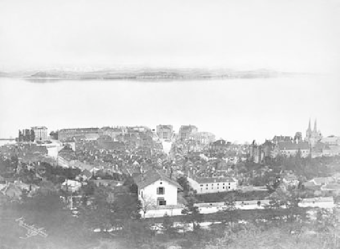
fig. 4.2. The center of the town of Neuchâtel, circa 1871, not long after the start of major
hydrological work in the Jura region to prevent flooding and improve irrigation. The
view of the Alps at the top was added to the photograph in a nod to the local tradition of
landscape painting. Source: Musée d'art et d'histoire, Neuchâtel (Switzerland).
Club and the Bern Naturforschende Gesellschaft and a collector of miner-
alogical specimens. His report on the events of 1885 was remarkable for
its detailed exposition of the geography of the affected region. As the com-
mission director forster noted, “Herr Pfarrer Ischer was all the more suited
to deliver a competent judgment on this situation, as he brings together
precise knowledge of general geology with a special local knowledge [
Lokal-
kenntniss
] of the obersimmenthal, where for years he had a parish.”
91
Still, devoted naturalists like Gempeler and Ischer could have contrib-
uted only a small fraction of the thousands of observations collected by
the commission. The experiences of a wider assortment of observers can be
glimpsed from the surviving original correspondence, which comes from
the Jura region, with its capital in Neuchâtel. The city of Neuchâtel sits be-
tween the Neuchâtel lake and the Jura Mountains, and was home to a famed
watchmaking microindustry in the nineteenth century (see figure 4.2). So-
cially, it was marked by a pronounced division between the hills and valley,
between the “montagnons” peasants—celebrated by rousseau as survivors