Geoscience Reference
In-Depth Information
(
T
C) into a moist atmosphere (without tem-
perature inversions that might prevent high ascent) and
where the generally converging flow of easterly waves in
the trade winds causes upward motion. Very low core
pressures (~950 mbar) attract adjoining trade winds over
a large area, for about 80-90 percent of hurricane
motion depends upon flow and pressure conditions in
the
steering flow
of the adjacent undisturbed atmosphere.
The cyclone's vorticity comes from shallow atmospheric
conditions that cause cyclonic (anticlockwise in northern
hemisphere) shear enhancement of positive vorticity
(Section 3.8) - this is commonly due to convergent flow
causing rising air masses to form.
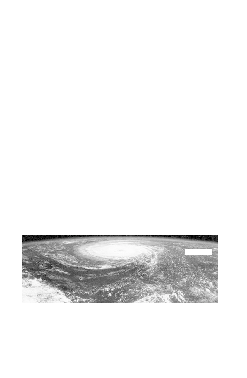
Cyclone morphology is distinctive (Figs 6.17 and 6.18),
comprising a mass of high velocity anticlockwise-revolving
clouds rimming a clear and relatively still core. Incoming
winds are forced to turn anticlockwise by the Coriolis force.
The rapidity of this process around the hurricane eye means
that a narrow diameter “solid” mass of still air blocks
an outer mass of spinning air. In terms of force balance, the
pressure gradient from vortex to center is balanced by the
inward centripetal acceleration and thus an outward cen-
trifugal force (Section 3.7). Once inside the developing
hurricane vortex
the moist winds are forced to spiral upward,
further warming up by the latent heat released from con-
densing water vapor as they do so. Once at high levels
(
c
.12 km) divergent flow occurs outward and downward
above the troposphere and this is turned by the Coriolis
force to assume a clockwise rotation that accelerates the risen
air far outward as cirrus clouds. Thus a vertical energy trans-
fer cycle from ocean surface to tropopause is set in progress.
At this stage the nascent hurricane is sensitive to the
temperature difference between its core and the wider
26-27
surrounding ocean waters; perhaps a difference of just a few
degrees celsius or so increase enables the central hurricane
eye with intense downdrafts to form. Certainly it is well
documented that hurricanes traveling onto warmer ocean
current gyres (if only differing by 2-3
C) may undergo
rapid pressure intensification (“rapid deepening”) and
wind acceleration, as observed with Hurricane Opal in
October 1995. Rapid deepening is believed to be the
mechanism whereby an average hurricane is transformed
into a very dangerous storm: it signifies the very great
importance of heat interchange between surface ocean and
atmosphere under such conditions. Successful hurricane
prediction models treat the phenomenon thermodynami-
cally, with the hurricane as a
heat engine
running between
the warm ocean and the cool troposphere, with a
T
of
some 100
C. However, corrections must be made for the
effect of increased hurricane winds causing surface ocean
layer turbulent mixing and therefore cooling due to
momentum and heat transport in the dynamic models.
In addition to their obvious role in increasing wind
shear and forward momentum transport in associated
waves, tropical cyclones have two major effects on the
ocean itself. First, their cyclonic flow sets up a divergence
of water (Fig. 6.16) in the top 100 m or so of the oceanic
surface boundary layer (Section 6.4). This leads to
upwelling and mixing of cooler waters over a large area in
the track of the storm (an effective “fingerprint” when
seen using thermal imagery). Second, the extremely low
pressures associated with the center of the cyclone cause a
rise in local mean sea level independent of any wind shear
effects or state of the local tidal wave. This effect is termed
a
storm surge
, with a possible rise in sea level of over 5 m,
in the most intense storms.
Cloud spirals record
convective upwelling
Calm, cloudless eye
Line of section
Fig. 6.17
Tropical cyclone from space.


Search WWH ::

Custom Search