Geoscience Reference
In-Depth Information
Pseudo-Random Code
(PRC) that is unique to the GPS. This
code consists of a complicated sequence of on/off pulses that
travel at the speed of light (299,300 km/sec; 186,000 mi/sec)
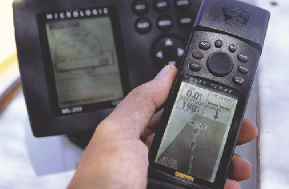
in space and can be acquired by receivers on Earth. Figure
2.29 shows an example of a hand-held GPS receiver. The
fundamental principle of GPS is that by knowing the positions
of satellites in space, the exact time that a signal is sent from
a given satellite and received by a receiver, and the speed of
the incoming PRC, you can use this artificial constellation
of satellites as locational references through a system of
triangulation.
Massanutten
Mountain
Blue Ridge
Shenandoah
Valley
Figure 2.27 Radar image of Shenandoah National Park in
the Appalachian Mountains.
This image was acquired with C-
Band Interferometric Radar during the Shuttle Radar Topography
Mission (SRTM) and subsequently color-coded to show elevation.
Greens represent topographically lower areas, rising through yel-
low, red, and magenta, to bluish white at the highest elevations.
Figure 2.28 The GPS satellite system.
Satellites are posi-
tioned in six orbital planes, with four satellites in each orbit (24
total), and are about 20,200 km above Earth's surface. This array
provides complete coverage of Earth.
or from space. In the latter instance, the most extensive ra-
dar imagery was acquired in the Shuttle Radar Topography
Mission (SRTM), during which virtually all the surfaces on
Earth were mapped with radar. In contrast to passive systems,
which can be limited when cloud cover is extensive, radar can
“see” through the clouds and can therefore be used all the time.
As a result, radar has been extensively used to map the sur-
face of Venus, which is masked by continuous cloud cover. On
Earth, radar is especially effective at mapping geological for-
mations in mountainous landscapes such as the Appalachians
(Figure 2.27).
Global Positioning Systems
Another way that digital technology has benefited geographers
is in determining location within the geographic grid. With
the proliferation of satellites in the late 20th century, the U.S.
military developed a system that enables people to determine
their geographic location quickly and with much greater
precision than with the use of a map. This system is called the
Global Positioning System, or GPS, and is based on a network
of 24 satellites that orbit Earth every 12 hours (Figure 2.28).
These satellites continuously transmit a radio signal known as
Figure 2.29 A hand-held GPS receiver.
This unit receives the
PRC signal from satellites in the GPS constellation.