Geoscience Reference
In-Depth Information
260 million hectares (642 million acres) of irrigated land and
has the potential to severely limit world food production.
Every inhabited continent has areas that are being affected by
salinization, with Australia leading the way at over 84 million
hectares (209 million acres) affected. In the United States, sa-
linization may be lowering crop yields on as much as 25% to
30% of the nation's irrigated lands. In Mexico, salinization is
estimated to be reducing grain yields by about 1 million tons/
year, which is enough to feed approximately 1 million peo-
ple. The remainder of this case study examines two examples
of salinized soils—the San Joaquin Valley of California and
Australia.
generally lies less than 122 m (400 ft) above sea level. Given
the higher elevations of the Coast Ranges to the west, the San
Joaquin Valley lies within a rain shadow and thus receives less
than 38 cm (15 in.) of rainfall per year. The climate of the re-
gion is generally classified as hot low-latitude steppe (
BShs
)
and even low-latitude desert (
BWh
) in places, with hot and dry
summers and cool, damp winters. The northern part of the re-
gion is drained by the San Joaquin River. Streams in the south-
ern end of the valley flow into Tulare Lake in the Tulare Basin.
In spite of the semi-arid climate of the region, the San Joa-
quin Valley is one of the most important agriculture zones in the
United States, with 5 of the top 10 farming counties in the coun-
try. The valley has often been referred to as the
nation's salad
bowl
for the amazing array of fruits and vegetables grown here.
If you happen to like asparagus, grapes, raisins, almonds, and
pistachios, they are likely grown in the San Joaquin Valley. In
addition, the largest single cotton farm in the country is found
here. Agriculture has been so successful in the valley because
a complex irrigation network was developed that delivers water
to fields whenever it is needed (Figure 20.16).
Large-scale diversion of water began in 1935 when the Bu-
reau of Reclamation launched the
Central Valley Project (CVP)
.
Like the hydrological projects we viewed previously around Las
Vegas, the purpose of the CVP (and later, the State Water Project)
has been to manage water resources in central California and,
among other things, relocate water with a system of dams and
canals from the humid northern part of the Central Valley to the
more arid south. In addition, the underlying Central Valley aqui-
fer has been systematically tapped, much like the High Plains
aquifer discussed in Chapter 15. Taken together, these water proj-
ects have turned what was previously a semi-arid desert into pro-
ductive farmland. As a result, the area is now considered by some
to be the engine of the California economy. This significance is
not to be underestimated, as the California economy provides
13% of all goods and services in the United States and would
be the 10th largest in the world if the state was its own country.
The San Joaquin Valley in California
Perhaps the best example of the impact of soil salinity in the
United States today is the San Joaquin Valley of California,
which encompasses the southern half of California's Cen-
tral Valley (Figure 20.15). In contrast to much of the rest of
California, the valley terrain has very limited relief due to the
complex geological history of the area. The geological foun-
dation of the valley was created when subduction along the
North American coastline during the Mesozoic Era established
a structural basin that lay below sea level. This basin was later
filled with about 7600 m (25,000 ft) of marine sediments. These
deposits were then buried by as much as 730 m (2400 ft) of al-
luvial sands and gravels derived from the rising Coast Ranges to
the west and the Sierra Nevada to the east. Taken together, this
depositional sequence created an extremely flat landscape that
Sierras
S
S
e
e
er
r
r
s
San Joaquin
Valley
S
S
S
S
S
S
n
n
n
n
J
J
a
q
u
u
u
u
Consequences of Irrigation
Nevertheless, the impact of
irrigation on the natural environment in the valley has been ex-
tensive. In some places, withdrawal of water from the Central
Valley aquifer has caused the land surface to subside, with mil-
lions of dollars of damage to buildings, aqueducts, bridges, and
highways. Irrigation has also caused extensive salinization of the
soils in the valley (Figure 20.17), the effects of which have been
magnified by the hydro-geologic relationships in the area. To wa-
ter their fields, farmers divert water from irrigation canals or draw
fresh groundwater from the Central Valley aquifer (Figure 20.16).
Early on, these irrigation strategies were beneficial to the soil be-
cause they flushed salts from the sediment, which naturally oc-
curred given the marine geologic history of the region. Unfortu-
nately, a fine-grained marine deposit, called Corcoran clay, lies at
a shallow depth below the surface in the central and western parts
of the valley. This clay layer is impermeable, which causes perco-
lating irrigation water to perch on top of it and the water table to
rise. Because this part of the groundwater system does not reach
the freshwater in the main aquifer, the groundwater perched on
u
n
V
V
V
V
V
V
V
V
e
e
e
e
y
Pacific
Ocean
Pacific
Ocean
Conversion Scale
cm
5
10
15
20
25
30
40
50
75
100
in.
2
4
6
8
10
12
16
20
30
40
Coast
Ranges
Tula
re
Basin
Tulare
Basin
0
25
50 km
0
25
50 mi
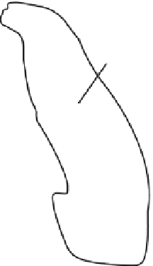
Figure 20.15 The San Joaquin Valley.
Map of annual precipi-
tation within the San Joaquin Valley and surrounding area. The
dry area on the west side of the valley lies within the rain shadow
of the Coast Ranges.


