Geoscience Reference
In-Depth Information
d i s c o v e r…
URBAN SPRAWL
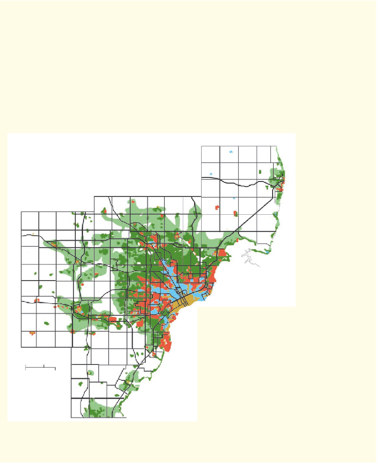
Urban sprawl is the expansion of cities outward from the
original central core into formerly rural land. It is usually associ-
ated with increased suburbanization and expanding traffic net-
works, such as the example shown here at Phoenix, Arizona,
in the lower right. Geographers like to visualize the spatial pat-
terns of sprawl by mapping changes at specific intervals over
time. For example, look at this map to see the patterns of ur-
ban sprawl in the Detroit metropolitan area in southeast Michi-
gan since 1890. It is color-coded to illustrate the progression
of urban expansion over time. The impacts of suburbanization
on the physical environment are extensive, including defores-
tation, the loss of farmland, increased storm runoff because
more surfaces are covered with concrete, a greater possibil-
ity for the urban heat island effect, and enhanced atmospheric
CO
2
concentrations because more people are commuting far-
ther to and from work.
Sanilac
St. Clair
N
Port
Huron
Genesee Lapeer
Shiawassee Genesee
1890
1920
1950
1980
2010
Livingston
Livingston
Livingston
Washtenaw
Livingston
Washtenaw
Oakland
Washtenaw
Oakland
Washtenaw
Washtenaw
Lenawee
Washtenaw
Lenawee
Wayne
0
10 km
0
10 mi
Lucas Co. Ohio
This map shows the expansion of the Detroit metropolitan area
over time. Growth patterns like those shown here have occurred
in a number of American cities during the past century.
A typical suburban landscape in Phoenix, Arizona. This landscape
was formerly desert that has been converted to a neighborhood
setting.