Geoscience Reference
In-Depth Information
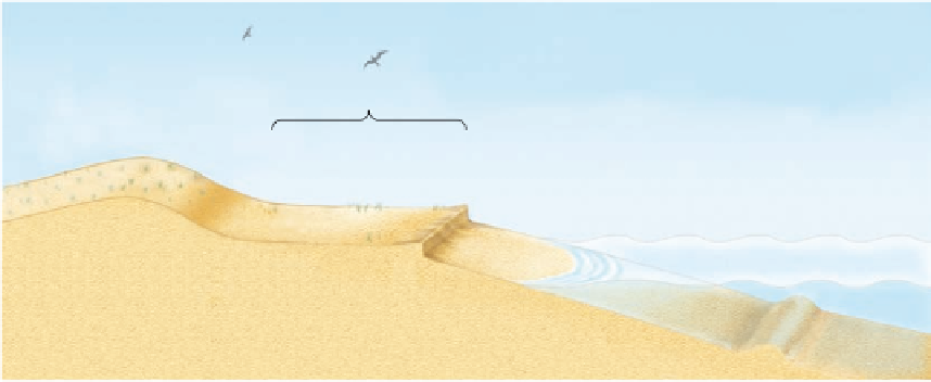
Dunes
Backshore
Foreshore
Offshore
High-water line
(high tide)
Low-water line
(low tide)
Berm scarp
Offshore bar
Figure 19.21 Generalized beach cross section.
Beaches are divided into several regions, with each
associated with a different water level or the action of wind.
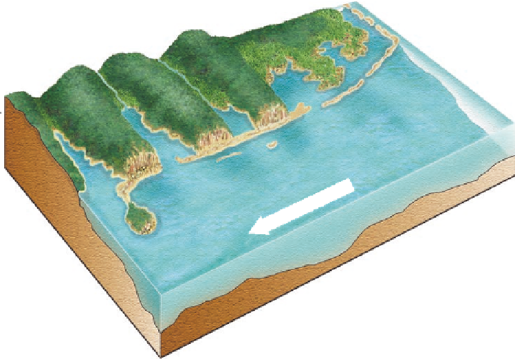
the landmass. Once the current encounters the mouth of a deep
bay, however, it loses velocity in a manner consistent with a
stream's loss of velocity when it meets the ocean. As with river
deltas, sediment carried by the longshore current is deposited in
a predictable fashion that produces distinctive landforms in bay
areas (Figure 19.22).
The variety of landforms created by the deposition of long-
shore drift in bays forms a geomorphic continuum that evolves
with time. This continuum begins with the formation of a
spit
,
which is a linear bank of land that extends into a bay when
longshore sediment is deposited (Figure 19.22). An important
distinction to make here is that a spit is connected to land on
the upcurrent side of the bay and extends into open water on
the other side. A spit is usually straight for most of its length,
but typically curves landward at its tip, forming a hook when
viewed from the air above. This form develops because at the
same time the longshore sediment is being deposited as the
spit extends, incoming waves are moving the tip shoreward.
Cape Cod, Massachusetts is an excellent example of a curved
spit (Figure 19.23). With sufficient time, the spit could extend
entirely across the bay, closing it off with a landform called a
Spit
A linear bank of land that extends into a bay made by the
deposition of longshore sediment.
Lagoon
Bay
Barrier
islands
Open
ocean
Baymouth
bar
Mainland
beach
Spit
Tombolo
Figure 19.22 Depositional coastal landforms associated with littoral processes.
On a
depositional coast landforms such as spits, tombolos, and baymouth bars form where sedi-
ment accumulates due to littoral processes.