Geoscience Reference
In-Depth Information
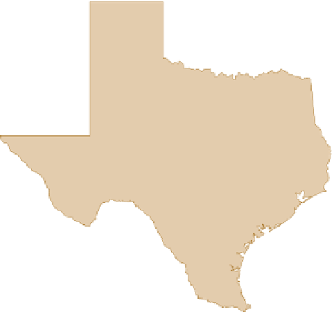
N
TEXAS
Direction of
longshore
current
irec
D
i
of
tion of
D
i
ti
re
c
o
o
o
D
e
c
ong
o
shore
g
lon
g
s o
o
gshore
r
curren
c
re
n
0
50
50
150 km
Gulf of
Mexico
0
100 mi
Zone of
parallel
waves
Figure 19.12 Interaction of waves and shoreline along the
southeastern coast of Texas.
Approaching waves in this part
of the Gulf come from the southeast. In the central part of the
coast, the incoming waves travel parallel to the shore. Due to
the concave nature of the coast, however, the waves strike the
northeastern and southwestern portions of the shore obliquely,
forming longshore currents that funnel sediment into the central
part of the coast where they converge. (
Source
: Texas Bureau of
Economic Geology, the University of Texas at Austin.)
Direction of
longshore
current
Direction of
t
Di
D
i
ti
re
c
o
o
D
c
o
o
ongs
shore
g
longs o
o
shore
curren
c
r
r
n
VISUAL CONCEPT CHECK
19.1
With your understanding of littoral pro-
cesses in mind, examine this image from
Queensland, Australia. Assume the axis of
the coast is aligned north and south and see
if you can determine:
a)
The direction of wave-forming winds
b)
Which way the longshore current is
flowing
c)
Which way the beach drift is moving
Hint
: North is at the bottom of the photo.