Geoscience Reference
In-Depth Information
+#
)
!*
'((
!"#$
(a)
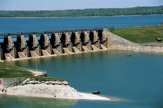
Figure 16.38
(a) Dams on the upper Missouri River.
Six major dams (and associated reservoirs) were con-
structed along the upper Missouri River to produce
hydroelectricity, improve flood control, and provide a
source of excess water for irrigation. (b) The Gavins
Point Dam. This dam was built in the late 1950s and
borders the states of Nebraska and South Dakota. It
impounds Lewis and Clark Lake, which has a surface
area of 130 km
2
(50 mi
2
).
(b)
shipping if the drought continued. Such closure would threaten
a $7 billion industry and potentially raise prices for food com-
modities both in the United States and abroad. As a result,
barge companies, the governors of Missouri and Illinois, and
water from reservoirs in the upper Missouri watershed—to no
avail. This problem is an excellent example of how a river basin
should be viewed holistically and how decisions made far way
(in this case, the northern Great Plains) have far-reaching ef-