Geoscience Reference
In-Depth Information
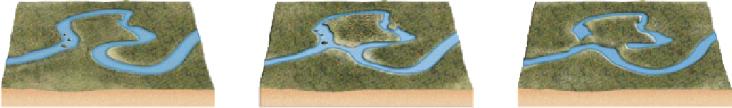
Figure 16.25 Meander evolution and formation of an oxbow
lake.
(a) Meander in the process of cutting off on the East River
in Colorado. (b) Schematic views of the evolution of this meander.
Diagram (1) illustrates the possible appearance of the meander
before a breach of the neck occurred. Diagram (2) shows the
landscape in its present condition. Diagram (3) illustrates how
the oxbow lake may look when the meander ends seal with
sediment.
(a)
Cutbank
Cutbank
Point
bar
Developing
cut off
Oxbow
lake
Neck
Point bar
(1) Meander forms
(2) Cutoff develops
(3) Oxbow lake forms
(b)
former meander bend that was detached from the main channel
in a stream valley. This lake develops when the stream erodes
the cutbank as water migrates downstream. At the same time
that cutbank erosion is occurring, deposition of sediment takes
place at the corresponding point bar. Given the combined im-
pact of these processes, the neck between meander loops gradu-
ally becomes narrower. Ultimately, one or more meander loops
can be entirely cut through when the stream floods. This neck
cutting is part of the stream's continuous process of gradient
adjustment and results in a temporary lake (Figure 16.25). With
time, an oxbow will usually fill with sediment derived from ma-
jor floods along the active channel. In the first stages of sedi-
ment infilling, the oxbow will become a swamp that contains
plants such as reeds and cattails. As sediment continues slowly
to accumulate with successive floods, the swamp will ulti-
mately fill completely with alluvium. Nevertheless, evidence
that an oxbow lake was once present will remain in the form of
a
meander scar
.
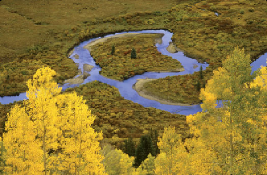
important because meanders slowly cut into the side slopes, or
bluffs
, that flank the channel, causing stream valleys gradually
to widen, as you can see in Figure 16.22d. Note in this dia-
gram that the stream valley is now broad, essentially flat, and
bordered by steep, rocky bluffs.
A stream valley usually contains thick deposits of al-
luvium that were deposited by the combined processes of
point-bar development and overbank deposition during
large floods (Figure 16.26). During floods, the coarsest
sediments (usually sand grains) are deposited along the
channel margin because they cannot be carried far away
from the stream due to their size. This near-channel deposi-
tion results in a ridge-like landform along the river called a
natural levee
that may be 1 m to 2 m (3.3 ft to 6.6 ft) high.
Finer silt and clay-sized particles are carried farther away
from the stream during floods and, when deposited, form
low
backswamps
because they are poorly drained, for rea-
sons outlined in Chapter 11.
Overall, however, the combined processes of meander
development, point-bar formation, and overbank deposi-
tion produce the low relief of the stream valley. This part of
the landscape is typically called the river
loodplain
because
it can be submerged during large floods, even though such an
event may be rare. The river floodplain differs slightly from the
Valley Widening and Floodplain Formation
In the con-
text of stream meandering, remember that the processes of cut-
bank erosion and point-bar deposition occur simultaneously.
These combined processes cause stream meanders to migrate
across the valley over time. This lateral migration, in turn, is
A small ridge that develops along the channel
of a stream through the deposition of relatively coarse sediment
Marshy floodplain landforms that develop
behind natural levees in which fine-grained sediments settle
Natural levee
Backswamps