Geoscience Reference
In-Depth Information
Saudi
Arabia
Egypt
Nile R.
Sudan
Eritrea
Ethiopia
(b)
(c)
Uganda
Lake
Victoria
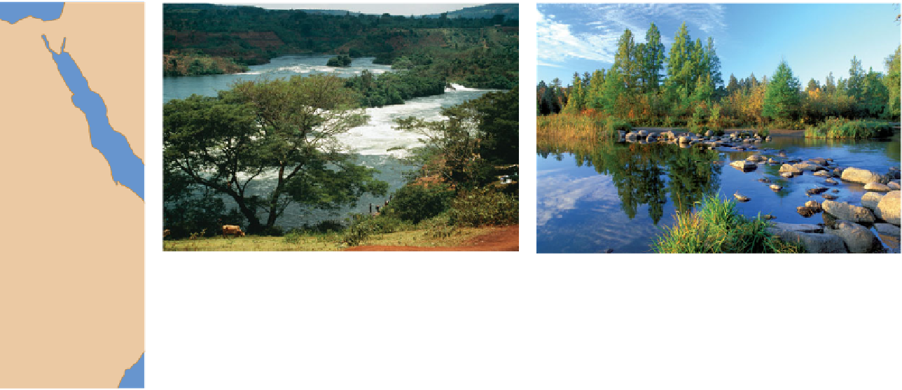
Figure 16.2 Sources of major rivers.
(a) The Nile River begins at the north end of Lake Victoria and flows
northward for about 10,730 km (6670 mi) before it ultimately reaches the Mediterranean Sea in Egypt. (b) This
image shows Bujagali Falls in Uganda. This waterfall is located just downstream of Lake Victoria, which is the
source of the Nile River. (c) The source of the Mississippi River at Lake Itasca, Minnesota. The boulder bridge
marks the point where the Mississippi flows out of the lake (to left of boulder bridge) on its journey south to the
Gulf of Mexico, Ʈ4100 km (2550 mi) away.
Kenya
200 500 km
500 mi
Tanzania
is free to move from the soil downward through the force of
gravity. At the same time that water is moving downward
through the soil, water runs off the surface and toward the
stream as overland flow (Figure 16.3). You can see the pro-
cess of runoff clearly in any parking lot during and shortly
after a strong storm. The asphalt keeps water from soaking
into the soil beneath; as a result, the water flows across the
surface in sheets toward a drain of some kind. This type of
runoff, called
sheet runoff
, also occurs in areas where slopes
are very steep and rainfall simply does not have a chance to
soak into the ground.
Drainage Basins
The next step in our discussion of stream systems is to con-
sider how they are spatially organized. A good place to begin
is to consider the concept of a
drainage basin
, which is the
geographical area that contributes groundwater and runoff to
any particular stream. Another term frequently used to de-
fine the same area is
watershed.
To begin this discussion, some basic terminology must first
be established. Streams in any two watersheds are separated by
a topographic feature called a
drainage divide
, which is an area
Figure 16.3 An example of storm runoff.
During periods of
heavy rain, soils become saturated and water flows across the
surface. This kind of flow is an important source of stream water.
An area of raised land that forms a bordering
The geographical area that contributes ground-
Drainage divide
Drainage basin