Geoscience Reference
In-Depth Information
D I S C O V E R . . .
NATuRAL LAkES
Have you ever visited a region containing many natural
lakes? Such places are fascinating ecosystems and are
prime vacation spots for people. They are also favored
zones of development, specifically for second homes and
weekend cabins. Although natural lakes are very attractive
places to be, few understand their origin.
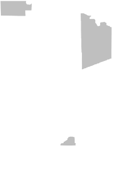
An excellent example of a region with numerous natural
lakes is the state of Minnesota, which is famous as the “Land
of 10,000 Lakes.” The majority of these lakes formed in top-
ographic depressions created by glacial ice between about
20,000 and 10,000 years ago. This landscape, as well as other
similar places in the upper Midwest in states like Wisconsin and
Michigan, looks this way due to an intimate and complex rela-
tionship between topography and local and regional water ta-
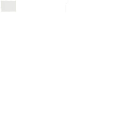
bles. A geographer or hydrologist can tell by looking at the map
of Douglas County, for example, that the elevation of the water
table must be high to create so many lakes. Examination of an
air photo of a typical Minnesota landscape further reinforces
this impression. The next time you are in Minnesota, or a place
where lots of natural lakes occur, try to look at the landscape in a
more holistic way and think about the local groundwater supply.
(b)
A geographer knows these lakes in Minnesota mean that
the regional water table is sufficiently high to fill depres-
sions with water.
N
Leaf Valley
Spuce
Millerville
0
2
4
6 km
Miltona
Lake Miltona
7
0 1 2 3 4 5 mi
Evansville
29
Belle River
Carlos
Brandon
95
82
Garfield
40
Douglas
County
Alexandria
Nelson
27
Holmes City
4
95
Forada
West 1
Douglas
114
Farwell
Pope
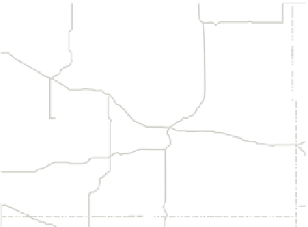
This map of Douglas County, Minnesota, illustrates why
the state is known as the Land of 10,000 Lakes. Most of
these lakes are associated with topographic depressions
created during the most recent glacial period.
(a)