Geoscience Reference
In-Depth Information
(a)
(c)
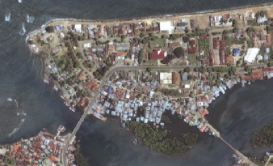
Figure 13.32 Satellite imagery of coastal devastation associ-
ated with the 2004 and 2011 tsunamis.
(a) Satellite image of
Banda Aceh, Indonesia, before the tsunami. (b) Satellite image
of Banda Aceh, Indonesia, after the tsunami. Note the change in
the configuration of the shoreline and the reduction in island size.
(c) Satellite image of a portion of Soma, Japan, before the tsu-
nami (left) and after (right). Note the dramatic change in the shape
of the coastline in the center part of the image.
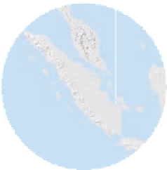
105 E
(b)
MALAYSIA
Kuala Lumpur
5 N
Banda Aceh
In contrast to the lack of
warning for people along the
coast of the Indian Ocean, the
Japanese had a very effective
warning system in place when
the 2011 event occurred. The Japa-
nese are well acquainted with tsunamis
(the name is Japanese:
tsu
meaning “strong” and
nami
mean-
ing “wave”) because about 200 major events have occurred in
their country alone in the past 1300 years. Given this high fre-
quency, as well the common occurrence of major earthquakes
along the various countries of the Pacific Rim, a tsunami warn-
ing system was established in the Pacific Ocean in 1949. In as-
sociation with this system, an extensive network of sensors was
deployed throughout the Pacific basin in the 1950s and 1960s
that monitors seismic events and associated fluctuations in sea
level. Enhancements to this system were motivated, in part, by
the great Alaska earthquake in 1964, which produced a wave
that reached a height up to 6.3 m (21 ft) in northern California
and killed 11 people.
Although this system is of little use during a sudden tsu-
nami, it can provide warning within 15 minutes for events that
originate far away. The effectiveness of the Japanese warning
system was apparent during the 2011 event. In comparison to
the incredibly high death toll associated with the Indonesian
tsunami, “only” about 16,000 people died during the Japanese
event. This relatively low death toll occurred because most
people quickly moved to higher ground when the warning was
Singapore
sounded. Of the people who unfortunately perished, about 65%
were over 60 years old, suggesting they could not move fast
enough to reach safety. Clearly, the Japanese tsunami system
saved lives. In this context, it is very good news that a tsunami
warning system was activated in the Indian Ocean in 2006. The
effectiveness of this system was tested when yet another large
(magnitude 8.4) earthquake struck Banda Aceh, Indonesia, in
2012. Nearby islands in the Indian Ocean were warned within 8
minutes that a tsunami might be approaching. Fortunately, that
particular earthquake did not produce such a wave.
A side story of the tragic Indonesian tsunami demonstrates
why it is important to understand natural Earth processes. As
previously discussed, most people had no idea that a tsunami
was approaching. As mentioned earlier, the only hint of some-
thing unusual was the rapid recession of water shortly before
the surge struck. To most people this withdrawal of water was a
source of curiosity, or even an opportunity to catch fish easily.
For a 10-year old British girl on a family holiday in Thailand,
however, it was a warning that a tsunami was approaching be-
cause she had just studied tsunamis in her primary school. She
keenly recognized that the sudden recession of water from the
beach meant a tsunami was approaching and thus pleaded with
her parents to run for safety. Her parents were understandably
skeptical at first, but she was insistent. As they left the beach,
the girl warned others nearby of the approaching disaster and
convinced them to leave. In the end, the awareness and persis-
tence of this little girl saved her life, as well as the lives of over
100 others.
Equator
SUMATRA
5 S
95 E
Indian
Ocean
105 E
100 E