Geoscience Reference
In-Depth Information
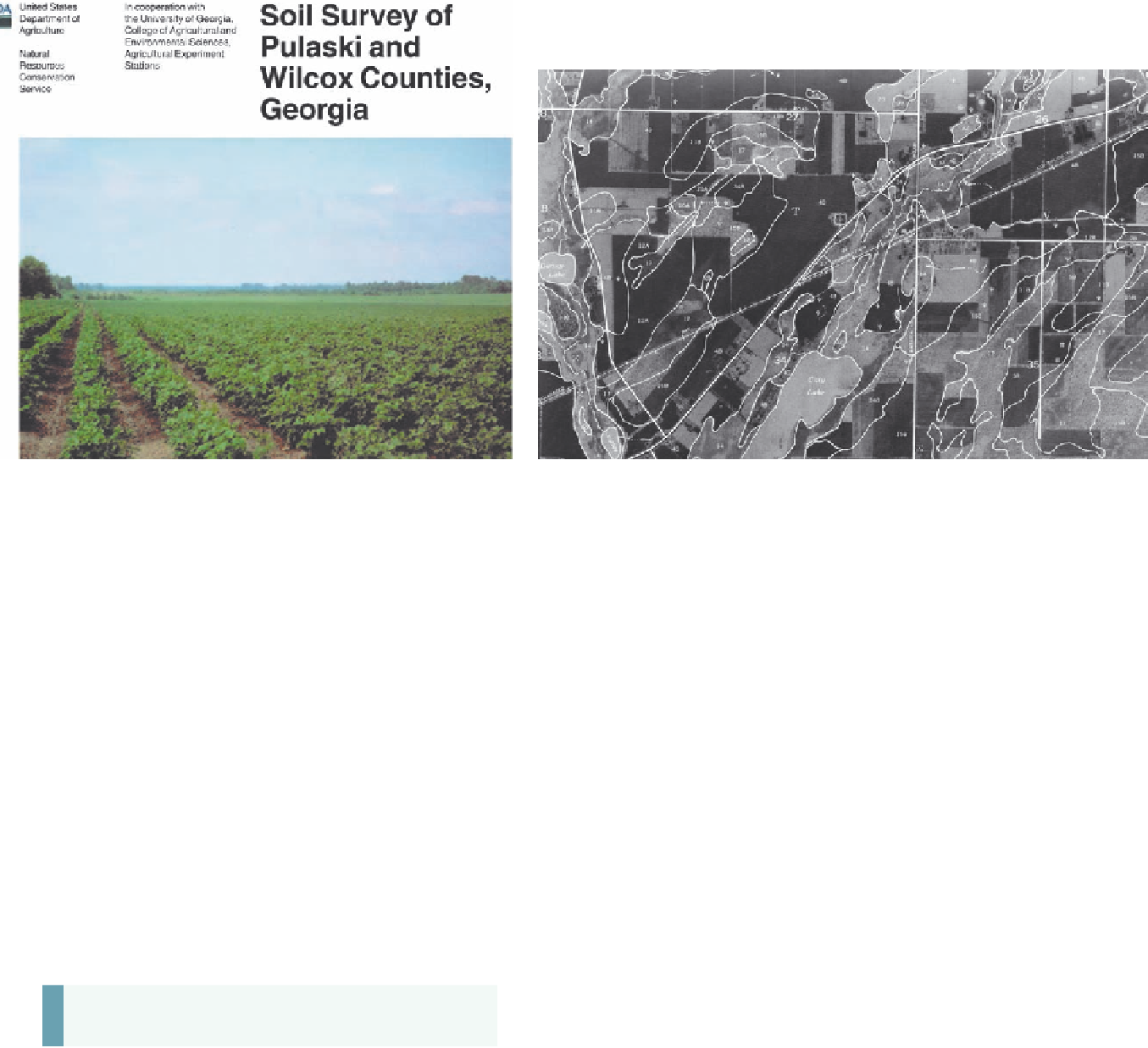
(a)
(b)
U.S. Department of Agriculture
Figure 11.39 County soil surveys.
(a) The cover of the soil survey for Pulaski and Wilcox counties, Georgia. Survey guidebooks such as
this one are available for most counties in the United States. (b) A typical soil map in a soil survey. Note the labels in distinct map areas, or
polygons. Each label represents a specific soil type (or series) in the area. Each series has distinctive characteristics, such as the degree of
development, color, texture, and structure, to name a few.
As a result of this environmental catastrophe, the federal government
established the Soil Erosion Service in 1933, which later became the
Soil Conservation Service in 1935. In 1994 the agency acquired its
current name, the Natural Resources Conservation Service.
The NRCS has an office in each county within the country and
employs field agents who consult with farmers, engineers, and other
residents who have questions about how they are utilizing soil. A key
reference published by the NRCS is the county
Soil Survey
, which
discusses the character of soils in the county and presents its geo-
graphic distribution in a series of accessible maps (Figure 11.39).
Soil surveys are often updated using refined mapping techniques
that allow farmers to practice precision agriculture, which maxi-
mizes yields by targeting specific crops to particular soil variations
within fields. These kinds of applications improve agricultural
efficiency, which, in turn, enables farmers to produce increasingly
greater amounts of food in a way that keeps costs low for you.
the basis of measured physical properties and hori-
zons.
3.
Oxisols and Ultisols form as a result of laterization,
which involves the intense weathering of soils in tropical
and subtropical environments. These soils are typically
reddish in color because minerals besides oxidized iron
and aluminum are leached.
4.
Alfisols and Spodosols form due to podzolization, which
involves extensive translocation of organic acids and
sesquioxides in cool, humid environments. Alfisols and
Spodosols have distinctive E horizons that are light gray
in color. Spodosols also have a distinctive Bs horizon
that forms due to the illuviation of iron and aluminum.
5.
Histosols are soils that are entirely organic because they
form in cool, humid places where the decomposition of
organic matter is very slow.
6.
Mollisols and Aridisols form in drier environments. Both
can form because of calcification, which occurs where
base ions are partially translocated in the soil. Aridis-
ols can also form due to salinization, which involves the
movement and surface recrystallization of sodium.
KEY CONCEPTS TO REMEMBER ABOUT
SOIL SCIENCE AND CLASSIFICATION
1.
Soil science is a distinct subdiscipline of geography that
focuses on the chemical, physical, and biological prop-
erties of soils.
7.
Andisols, Entisols, Gelisols, Inceptisols, and Vertisols
are directly related to local environmental factors. Andi-
sols form in volcanic environments, whereas Gelisols
occur in subarctic regions where the soil is frozen most
of the year. Entisols and Inceptisols can form anywhere
and represent soils that are very weakly to slightly better
developed, respectively. Vertisols are soils that contain
abundant expandable clays that swell when wet and
shrink when dry.
2.
One of the primary ways that soil scientists study and
compare soils is through soil classification. Soils are
classified (in the United States) through a hierarchical
system called
soil taxonomy
. The most general clas-
sification in soil taxonomy is the soil order, of which
12 orders are recognized. They are distinguished on