Geoscience Reference
In-Depth Information
Detroit
Boston
New York
Pittsburgh
Washington, D.C.
Atlanta
The Bahamas
Atlantic Ocean
Miami
Cuba
Jamaica
(a)
(c)
(b)
(d)
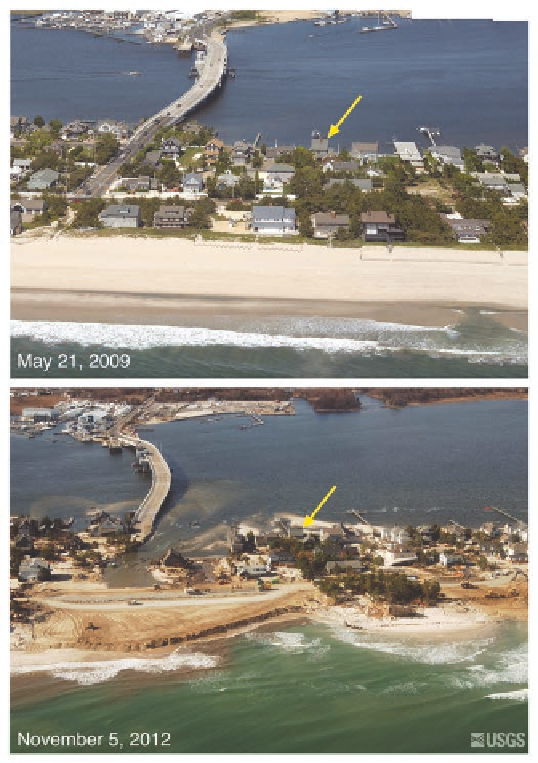
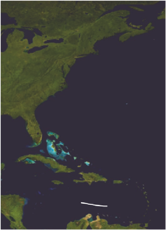
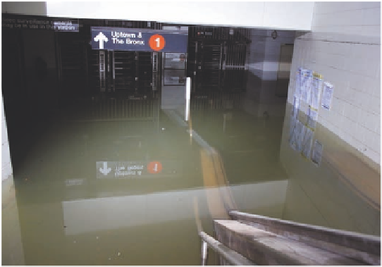
Figure 8.27 Hurricane Sandy.
(a) Track of Hurricane Sandy. Note the irregular track the storm took from the Caribbean to its landfall
on the U.S. east coast. (b) Visible infrared satellite image of Sandy after it made landfall. The storm was huge, affecting most of the
northeast United States. (c) Repeat photography of the coastline at Mantoloking, New Jersey. The top photo shows the area prior to
the storm in May 2009, whereas the lower image was taken shortly afterward. Storm waves and surge cut across the island, eroding
the beach, destroying houses and roads, and depositing sand. The yellow arrow in each image points to the same feature for refer-
ence. (d) Flooded subway system in New York City. High storm surge and waves flooded the southern part of Manhattan, including the
subway system.