Geoscience Reference
In-Depth Information
Convectional Precipitation
Now that you have completed the discussion of convectional
uplift, let's see what the effects of this process are in the real
world. Go to the
Geo Media Library
and select
Convectional
Precipitation
. This animation consists of a video that shows
how convection results in the formation of clouds and pre-
cipitation. After you complete the video, be sure to answer
the questions at the end to test your comprehension of this
concept.
is 28°C (82.4°F), whereas it is 29.5°C (89.1°F) in the surround-
ing body of air. Under these conditions, convection cannot con-
tinue because the air bubble is cooler than the main body of air.
As a result, the air sinks toward the surface and cloud formation
cannot occur.
Pacific Ocean is warmer than normal. This pattern produces am-
ple rainfall in the western Pacific due to high evaporation rates,
low air pressure, and unstable air. On the other side of the Pacific,
however, La Niña brings lower than average rainfall due to cooler
ocean temperatures, increased air stability, and less evaporation.
La Niña even has an impact in the central United States because
shifting atmospheric circulatory patterns cause the development
of a strong high pressure system in the region. This ridge of high
Human Interactions: Drought in
the U.S. Farm Belt
As you can imagine, discussion of humidity and precipitation
is highly relevant to people because food production is de-
pendent upon ample rainfall and available moisture for plants
and livestock. In normal circumstances, sufficient amounts of
precipitation fall within the agricultural regions of the United
States to produce healthy crop and livestock yields. At other
times, however, conditions develop in these zones where atmo-
spheric humidity levels remain low for months and sometimes
even years. As a result, below-average precipitation falls for a
lengthy period of time and drought conditions develop.
An excellent example of an intensive drought in the agricul-
tural heartland of the United States can be seen since 2011, espe-
cially in the Great Plains states of Texas, Oklahoma, Kansas, and
Nebraska. As you will see in the discussion of climate in Chapter
9, this part of the country has a sub-humid to semi-arid climate that
results from being in the rain shadow of the Rocky Mountains, as
well as far from the Gulf of Mexico, which serves as the primary
moisture source for the eastern United States. Although the Great
Plains are less humid than the moist eastern United States, enough
precipitation nevertheless falls in most years to produce healthy
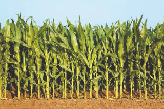
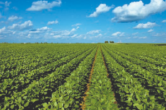
wheat, corn, soybean (Figure 7.27), and other crop yields. Thick
stands of range grass fatten cattle and other livestock for market.
Since 2011, however, a searing drought has gripped this part of
the country, one that is reminiscent of the infamous dust bowl that
decimated the region in the 1930s. It is certainly the most intense
drought in the past 50 years, with over 60% of U.S. farmland ex-
periencing moderate to extensive drought.
Atmospheric scientists have learned that the development of
drought conditions in the central United States is related to a va-
riety of interrelated global environmental factors that have been
discussed in the past two chapters. A particularly important vari-
able, which was in place in 2011 and 2012, is La Niña conditions.
If you recall from Chapter 6, La Niña occurs when the western
(a)
(b)
Figure 7.27 Healthy corn and soybean fields.
Scenes like this
are common throughout the U.S. farm belt in most years due to
plentiful rainfall and good growing conditions.