Geoscience Reference
In-Depth Information
3
Air rises and cools,
precipitation occurs
4
Airflow continues
to leeward side
much visual sense. Simply put, when airflow is interrupted by
a mountain range, the air must flow up and over the barrier. For
point of reference, the side of the mountain range that faces the
direction of the oncoming wind is called the
windward side
,
whereas the opposite, or downwind side of the range, is referred
to as the
leeward side
. If the range is sufficiently high for the
air parcel to reach its dew-point temperature through adiabatic
cooling on the windward side of the range, clouds form and
precipitation can potentially occur.
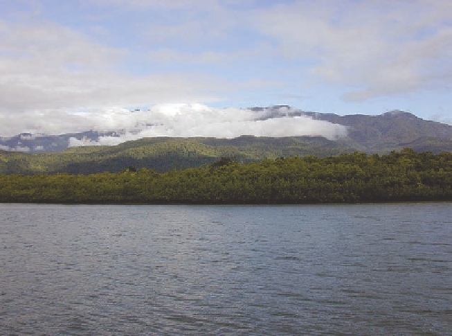
Figure 7.22 shows a hypothetical flow of air over a moun-
tain and a graph of the associated temperature changes, which
occur with altitude. The numbers in both images represent
specific points for comparisons in the process. In this exam-
ple, wind is flowing off the sea, let's say the Pacific Ocean, on
the left side of the diagram (point 1). As the air encounters the
mountain range, it begins to rise up the windward slope, cooling
at the DAR until it reaches the level of condensation at point 2.
From point 2, the air begins to cool at the WAR because con-
densation, cloud formation, and precipitation are occurring, re-
sulting in a landscape that may look very much like that pictured
in Figure 7.23. The air continues to cool at this lesser rate, due
to the release of latent heat of condensation, until the mountain
crest is reached at point 3 (Figure 7.22). Here, the specific humid-
ity of the air mass is less than it was at the level of condensation
because moisture was lost through precipitation. This moisture
loss is somewhat analogous to the water that is squeezed out of a
sponge. Subsequently, the parcel of air continues over the moun-
tain and descends on the leeward side (point 4).
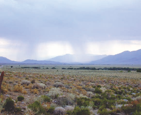
As the air descends down the leeward side of the mountain
range, a very interesting thing happens— the air dries rapidly.
Recall that when air descends, it warms adiabatically at the
DAR, which is 10ºC/1000 m (5.5ºF/1000 ft). This rate of warm-
ing takes place because as soon as the air begins its descent
5
Hot, dry air
on leeward
side, results in
rain shadow
2
Condensation level,
clouds form
Leeward slope
1
Warm, moist air
forced upward by
mountain chain
Windward slope
(a)
Temperature, °F
30
40
50
60
70
80
90
3500
10000
3000
3
8000
2500
4
Dry adiabatic rate
2000
6000
Wet
adiabatic
rate
1500
4000
1000
2
2000
500
Dry adiabatic rate
1
5
0
-5
0
5
15
Temperature, °C
10
20
25
30
35
(b)
Figure 7.22 Orographic uplift.
(a) When flowing air encoun-
ters a mountain range, it must flow over the top. As it does, the
air adiabatically cools on the windward side and warms on the
leeward side of the range. (b) Graph of the associated changes
in temperature with altitude.
(a)
(b)
Figure 7.23 Orographic clouds.
(a) These clouds formed on the windward side of a small mountain range along the northeastern coast
of Australia. (b) Orographic precipitation along the Inyo Mountains in eastern California.