Geoscience Reference
In-Depth Information
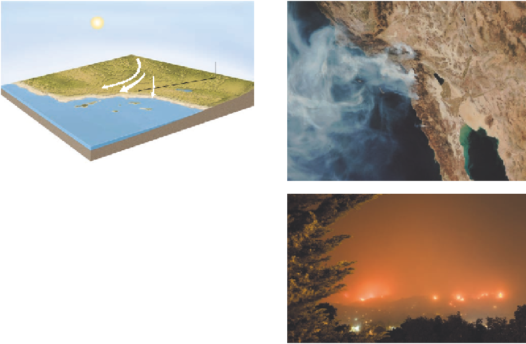
Santa Ana
Winds
Great
Basin
Sierra
Nevada
San
Bernardino Mts.
H
Pacific Ocean
San Diego
San
Gabriel Mts.
(a)
Los Angeles
(b)
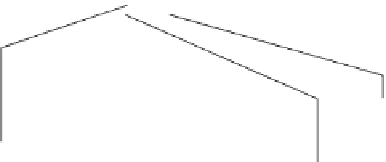
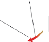
Figure 6.31 Santa Ana winds.
(a) Santa Ana winds develop
when high pressure over the Great Basin forces air up and over
the Sierra Nevada and other mountain ranges to the west. As the
air descends on the west side of the range, it picks up speed and
warms. (b) Satellite image of Southern California on October 23,
2007. Note the smoke plumes driven to the west (over the Pacific
Ocean) by the Santa Ana winds. (c) Nighttime view of the Jesu-
sita Fire in the hills near Santa Barbara in 2009. This fire burned
35.34 km
2
(13.5 m
2
) and destroyed 80 homes.
(c)
North Equatorial
Current
North Equatorial Current
Eq
uatorial Countercurrent
Equatorial
Countercurrent
Equator
South Equatorial Current
South Equatorial Current
South Equatorial Current
Antarctic Circumpolar Current
Antarctic Circumpolar Current (West-wind drift)
Warm current
Cold current
Figure 6.32 Global oceanic circulation.
Ocean currents fundamentally move in the same direction as the winds. Note, for ex-
ample, the easterly current along the Equator and how it relates to the easterly winds. The primary difference between ocean and air