Geoscience Reference
In-Depth Information
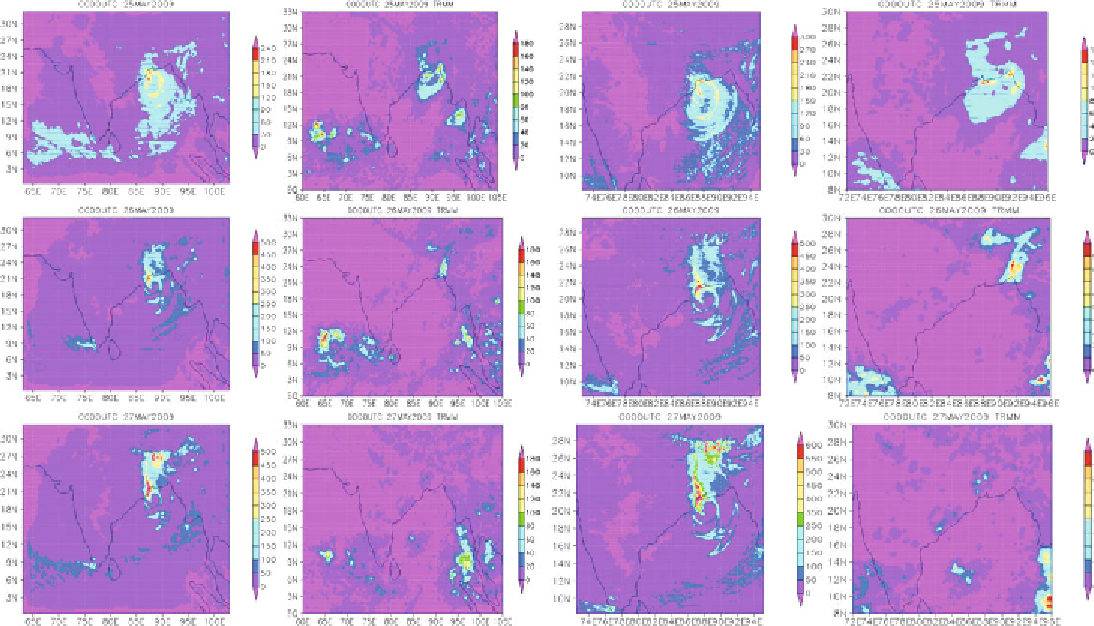
Fig. 6:
The model simulated 24 hrs accumulated rainfall (mm) with WRF (left ) and TRMM (mm) satellite images (right)
with 27 km horizontal resolution (left panel) and 9 km resolution (right panel).
Search WWH ::

Custom Search