Geoscience Reference
In-Depth Information
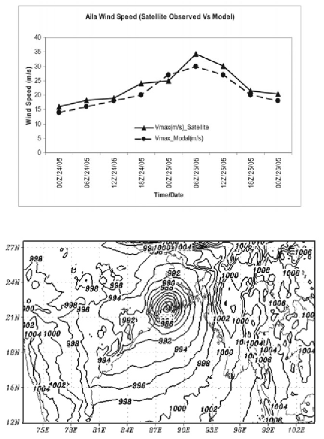
Fig. 5:
Comparison of satellite observed and model maximum wind of Aila.
Fig. 6:
Mean Sea Level Pressure field of Aila as obtained from WRF-ARW model.
5.4 Errors in Track Forecasting
The Vector Errors (VE) of Tropical Cyclone Track (geographical distance) is
calculated from latitudinal and longitudinal displacements. It is worthwhile to
note that RMSE of VE is calculated considering all the forecast points
(48 hours) throughout the passage of cyclone till the landfall and is found to be
66.6 kms.
Search WWH ::

Custom Search