Geoscience Reference
In-Depth Information
3,143 m and some of these mountains can be found very close to the sea. The
northern part of the department is the most mountainous part and this is where the
mountains reach their highest peaks, and as a result it is this half of the department
that experiences less forest fires because due to many different climatic reasons.
This is why the following example only deals with the southern half of the
department (Figure 8.4).
The Digital Elevation Model (DEM) which was used as part of the research was
the one that was created by the National Geographical Institute, known as BD Alti.
The GIS that was used was ArcView, ArcGis 8.3 and it was used in raster mode.
The use of ArcView made it possible to find out immediately what the exact altitude
of a particular pixel was. Almost instantaneously, it generated values for the
variable being researched, such as exposure, slope, relative altitude, and distance
from the sea. Today GISs are equipped with integrated functions so that they can be
used to perform immediate calculations of certain parameters, but these parameters
do not necessarily correspond to the parameters that we want to work with (Figures
8.5 and 8.6).
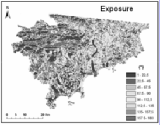
Figure 8.5.
A map showing the exposure of each pixel (from 1° in the
north to 180° in the south; the east and the west had the same values)
The slope of any given pixel is generally produced from the values of the
altitudes of its neighboring pixels, which does not correspond to our research. Our
research involves the search for a particular slope, which takes into consideration
the average steepness within a 600 m radius. The value of this newly defined slope
is then used in any future regressions, and is also used to provide information on the
characteristics of each pixel.