Geoscience Reference
In-Depth Information
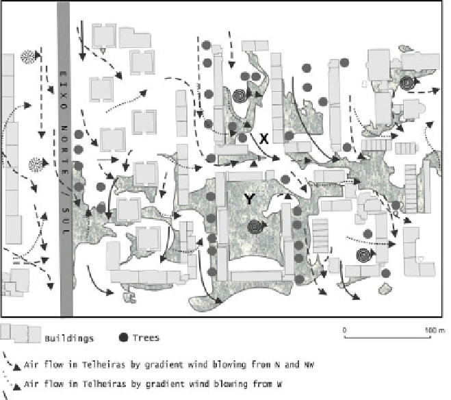
Figure 5.16.
Airflow in Telheiras by N , NW and W winds if z
0
increases to 1.5 m to the N of the city-district [LOP 03]
5.9. Conclusion
The objective of presenting different approaches and projects was to make clear
that in order to study urban climatology, it is not only necessary to monitor urban
climate parameters and to use sophisticated models, but also to possess accurate and
detailed geographical information, including urban morphology.
Furthermore, accurate measurements require accurate knowledge of the
geographical urban environment. Data acquisition is crucial to build and to validate
models, but any model may be seriously jeopardized by incorrect measurements.
The site of meteorological stations used must be precisely known and, if necessary,
the researchers have to set their own networks. In the ESCOMPTE Project, it was
shown that wide use was made of sophisticated ground-base and air and sea-borne
instruments.