Geoscience Reference
In-Depth Information
between 0.64 and 0.95) [ALC 06a]. The SVF is “the ratio of the amount of the sky
'seen' from a given point to that potentially available” (i.e. the proportion of the sky
hemisphere subtended by a horizontal surface) [OKE 87, p. 404].
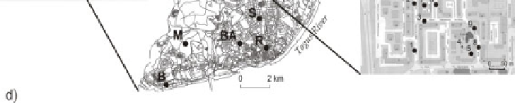
Figure 5.4.
Location and relief maps: a) Lisbon's region; b) mesoscale measurement
network in Lisbon (Portugal), B=Belém, BA=Bairro Alto, C=Carnide, PN=Parque
das Nações (Expo98), R=Restauradores, S=Saldanha; c) microscale
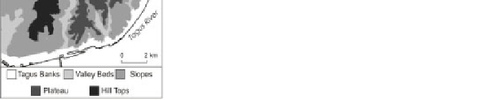
network in Telheiras (Lisbon); d) relief map
Examples are given in Figure 5.12 and will be discussed below. The measuring
points are well distributed within the whole city and include sites on the outskirts
(Monsanto Hill and Carnide northwards from Lisbon) and others directly on the
Tagus bank (Parque das Nações to the east (E) and Belém in the southwestern part
of the city) (Figure 5.4b). Measurements were taken at the height of 3.5 m, using
Gemini Data Logger's Tiny Talk devices (Figure 5.3c-e). According to Oke [OKE
06b] and Nakamura [NAK 88] “measurements taken at heights of 3 to 5m differ
little from those at the standard height, have slightly greater source areas and ensure
that the sensor is beyond easy reach or damage” [OKE 06b, p.17].
In a second project designed to study spatial variation of climate features within
a single city district, the data loggers were located in sites with different canyon