Geoscience Reference
In-Depth Information
4.5.2.
Soil types data
The FAO “Digital Soil Map of the World and Derived Soil Properties”
(http://www.fao.org/icatalog/inter-e.htm) provides information on the different soil
variables used in SVAT models. It does not cover all types of soils, but provides soil
properties such as the surface albedo and textural data (fraction of sand, limestone
and clay) at a resolution of 10 km, for three categories of soil color, texture and
drainage [MAH 95].
4.5.3.
Land cover data
4.5.3.1.
USGS data
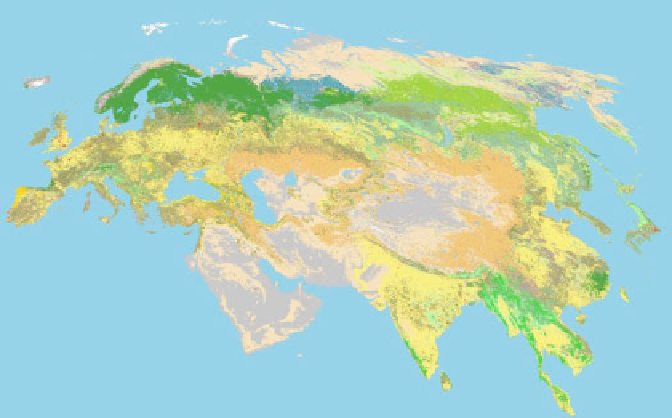
The USGS/EROS also provides information on vegetation cover at 1 km
resolution, derived from AVHRR (Advanced Very High Resolution Radiometer on
NOAA satellites). The data were first gathered between April 1992 and March 1993.
It was first published in 1997 at global or continental scales, and then updated in
1998 (Figure 4.18) (http://edcsns17.cr.usgs.gov/glcc/).
The database gives access to:
- the different types of ecosystems classified either into a large number of
classes, or into a limited number of classes consistent with those used in some
SVAT models (e.g. 13 or 18 classes for the SIB model);
- the land cover classification (20 classes) adopted by the International
Geosphere-Biosphere Programme (IGBP);
- seasonal variations of land cover.
Figure 4.18.
Types of ecosystems for the Eurasian area established by USGS/EROS