Geoscience Reference
In-Depth Information
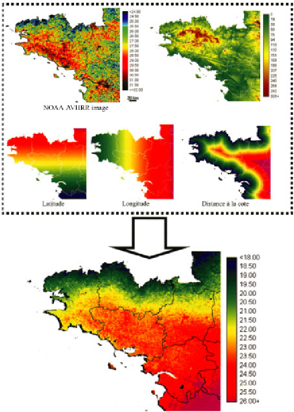
multiple regression formula. A map, or more precisely a new image with a spatial
resolution of 1 km is also created. This image shows that the air temperature value
of each measurement site depends on the geographical characteristics of the site and
on the surface temperature which is measured by the NOAA (Figure 3.8).
Figure 3.8.
An estimation of the maximum air temperatures taken on the April
10, 1997 in Brittany, France. The information was gathered from four
geographical variables and NOAA-AVHRR data (see color section)
3.4.3.
Monitoring drought in the region of Brittany by using the NDVI
Summer droughts are a major constraint in the field of climatology. They affect
water resources and cause problems as far as the growth of vegetation is concerned.