Geoscience Reference
In-Depth Information
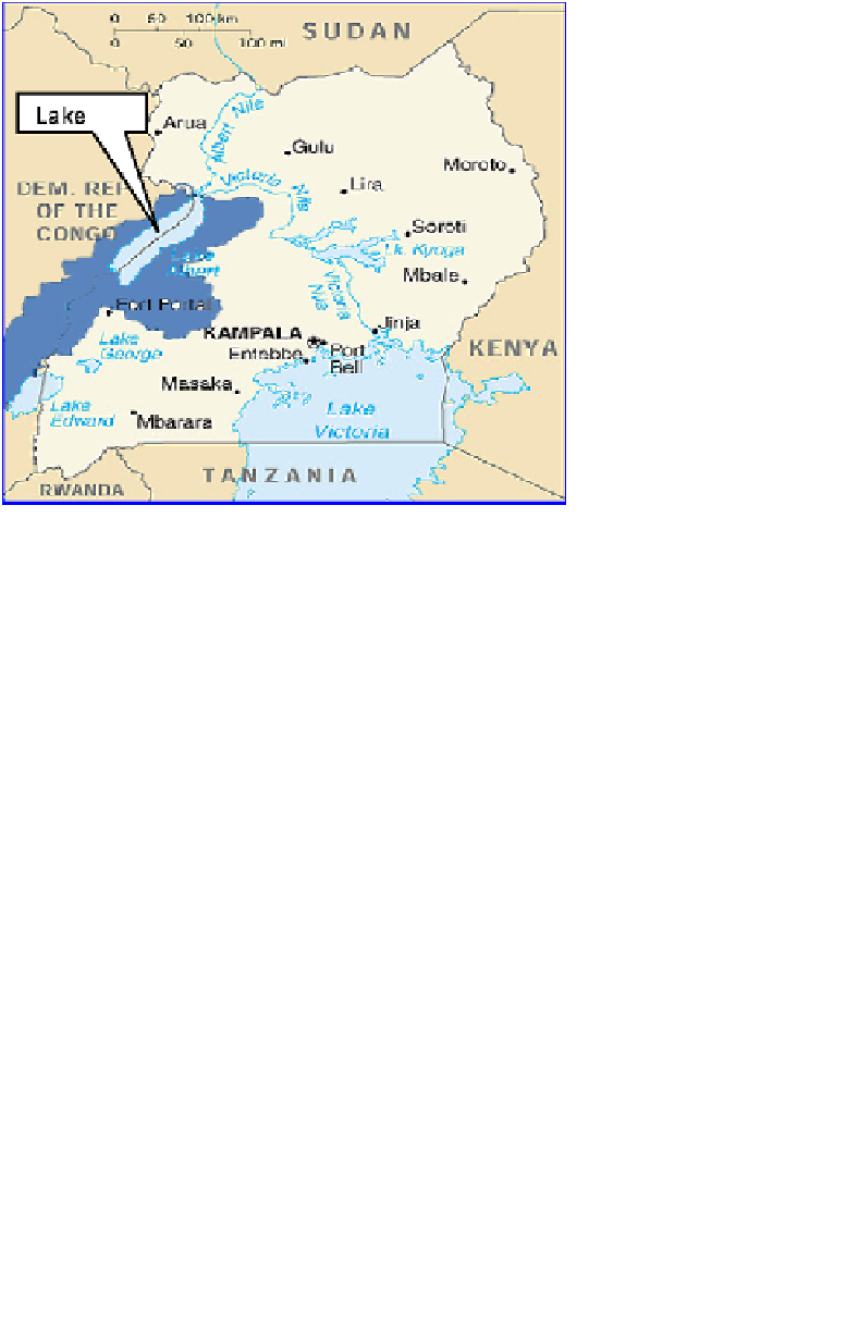
Fig. 1.
Uganda showing Lake Albert and its catchment area.
(DRC)
1
. The Lake Albert region is virtually the lowest point in Uganda at
an altitude of 619 m above sea level, making it one of the hottest parts of
Uganda. The geology primarily consists of banded gneisses of the basement
complex rocks and therefore negligible seepage occurs.
The main inflow to the lake is contributed by rivers Semiliki, Muzizi,
Nkussi, Wambabya, Waki I, Waki II, and Victoria Nile, while the outflow
is through the Albert Nile. The total inflow to the lake is estimated by
obtaining the sum of all the discharges of the above-mentioned rivers and
these are the ones that were considered in the study.
2. Methodology
2.1.
Data quality check
After identifying the rivers based on the map the catchment was delineated.
Flow data for the rivers were obtained for the period 1950-2000 and a
quality check was done using the double mass curve method.
The water balance for the lake was also obtained and is shown in Table 1.
Two methods were employed to infill missing data. These were the
normal ratio for missing data in a period of less than 12 months and the