Geoscience Reference
In-Depth Information
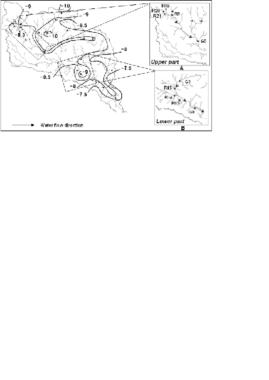
δ
18
O distribution in river water of the Huaisha River Basin.
Fig. 3.
built near the point G5 along the river direction, the enriched river water
disappears into underground and recharged the groundwater. The infiltra-
tion rates also high in the riverbed, because of the lower runoff the river.
This enrichment and similarity at the high altitude area suggested that the
groundwater recharged by the river water in this area (Fig. 3A).
In the lower part, the stable isotope values of river water revisal than
upper part. The isotope values of river waters at point R15, R14, and R13
were same and depleted than the upper part. This depleted values of river
waters similar to groundwater samples at point G3 and point G9 in low-
altitude area. This suggested that river water fed by the groundwater in this
region (Fig. 3B). Comparing with groundwater at point G1 (
δ
18
O around
−
8
.
46
‰
), the more enriched isotope values were observed in river water
at point R1 (
7
.
84
‰
for
δ
18
O) and spring water at point S1 (
7
.
67
‰
for
δ
18
O). Those river water and spring water were collected at the same point
of the lower part in the study area with low
d-excess
.The
d-excess
of surface
water sample lower than the groundwater sample which result of the evap-
oration in the lower part. This indicated that groundwater recharged to the
surface water, after that the evaporation contributed isotopic enrichment
to the surface water in the lower part of the Huaisha River Basin.
−
−