Geoscience Reference
In-Depth Information
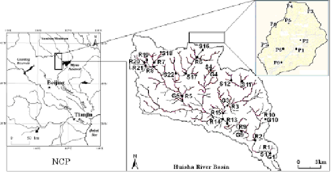
Fig. 1.
Sampling location in the study area of the North China Plain.
2. Hydrogeological Settings and Methods
Located at lower part of Yanshan Mountain in the NCP, the Huaisha River
Basin (Fig. 1) is typical basin in a hilly area as large as 155 km
2
. It belongs
to the littoral and semi-arid climatic zone, and annual rainfall ranges from
400 to 600 mm. Mean potential evaporation ranges from 1,100 to 1,800 mm.
2
The east-west trending Yanshan Mountain is underlies by Archian crys-
talline basement rocks.
3
The bedrock is composed of Archaeozoic gneiss
and Proterozoic carbonate. Generally, groundwater is recharged in Taihang
and Yanshan Mountains then moves eastward and southward to the Bohai
Sea.
1
Most recharge is from infiltration of precipitation near the outcrop
area around the mountains.
Precipitation, groundwater (shallow) and surface water (river and spring
water) were collected in September 2003. In several point in the study
area collected both groundwater and surface water. The
δ
Dand
δ
18
Oof
samples were measured by the mass spectrometer (Delta S Thermoqest) in
the laboratory of Chiba University.
3. Results and Discussions
3.1.
Stable isotopes of precipitation, groundwater, and
surface water
Isotope and precipitation data are presented in Table 1. Isotope composi-
tion of precipitation ranged from
−
8
.
38
‰
to
−
10
.
51
‰
for
δ
18
Oand
−
70
.
3