Geoscience Reference
In-Depth Information
35
30
TTUD (ir)
INDIA
25
20
A.P.
15
10
70
75 80 85 90
LONGITUDE (in degree)
17.25
17.2
17.15
0km
2km
4km
78.85
78.9
78.95
79
79.05
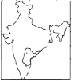
Fig. 1.
Location map of study area.
1.3.
Lineaments
The area is cris-crossed with lineaments. The prominent directions of these
are NW-SE and NE-SW. Although lineaments have been identified through
out the area, it is the lineaments in the pediplain or valley fill, which are
considered significant from groundwater occurrence point of view.
1.4.
Drainage
The drainage pattern, in general, is dendritic, typical of granitic terrain.
In the northern part these are dense. Many of these follow the straight
course along the lineaments in the central and southern part. Some of these
drainages culminate to tanks where rainwater is temporarily stored and
used for irrigating crops. The drainage density in the area has been calcu-
lated after digitization of the entire drainage pattern. It varies from 0.02 to
4.85 km/sq. km.