Geoscience Reference
In-Depth Information
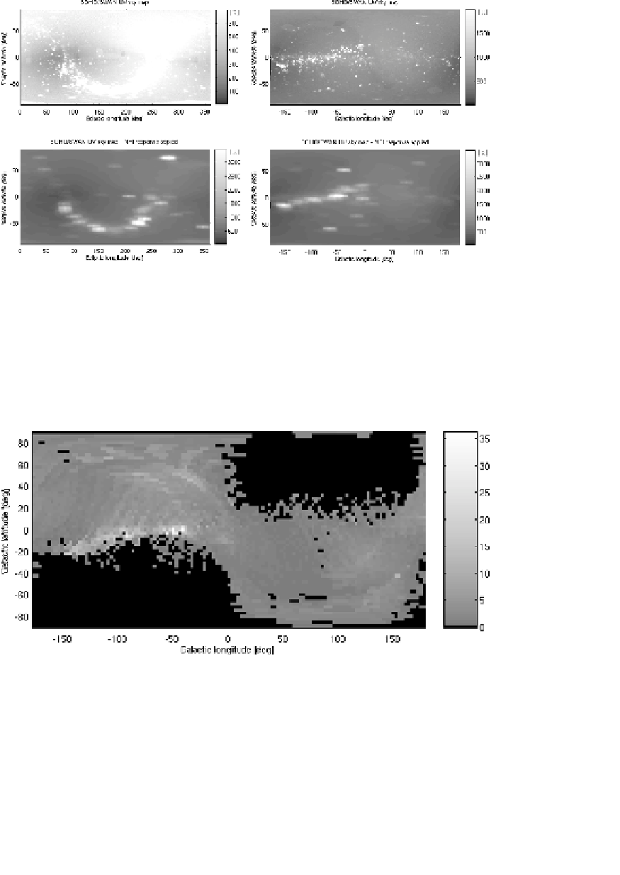
Fig. 7. SOHO/SWAN all-sky UV Maps on one degree resolution longitude-latitude
grids in the unit of Rayleighs. The instrument is sensitive to the wavelengths 117-180 nm.
The top row shows the raw images and in the bottom row we have convolved the images
with the response function of one NPI sector (from calibrations). The left column is
in ecliptic coordinates, and the right is in galactic coordinates. Note that the intensity
ranges in the plots were chosen to enhance the features. The maximum in the raw images
is 65 and 5 kR in the smoothed images. Data provided by Teemu Makinen on behalf of
the SWAN team.
Fig. 8. The NPI skymap for 2005 in galactic coordinates (longitude-latitude). Other-
wise the same as Fig. 6.